The hike travels through the Gorge, following the old road that has been used for thousands of years, first by the Fremont people, then by Mormon pioneers. About 1/2 mile in there are some petroglyphs that aren't in great shape, and then further on is the Pioneer Register. A lot of people just take the hike that far.
The Register is a place in the Gorge where early settlers left their names or initials and the date. There has been some copycat and destructive graffiti unfortunately, so sometimes it's hard to tell what you're looking at. Most are from the late 1800's but one of the clearest, on the right side and quite high up is from 1911.
Further down the trail, the walls of the gorge recede and other formations come into view.
I don't know where this trail ends, because after a little less than a mile, I had a choice to make. I've been doing some exercises to strengthen my knees and core muscles, and I am almost feeling ready to take a "moderate" hike. This explains my spontaneous decision to extend this hike to see The Tanks. It required some scrambling over rocks and some pretty steep step-ups, but I was fine. The trail is sometimes hard to follow, even for one so frequently used, but there are plenty of markers in most places. You just have to pay attention.
The Tanks are a series of pools that are remnants of a seasonal stream that must have been very strong at one point in geological history. I hiked as far as I could up the gorge that contains the Tanks. I suppose if folks are prepared to hike in the water they could go further. I walked around the edges of the water, which wasn't all that appealing, as at this time in the season it's stagnant, fed only by the monsoon rains.
Some of the Tanks are deeper than others, and I only saw two odd little creatures in them, that might have been tadpoles or some kind of freshwater shrimp. Great reflections of the surrounding rocks though.
After climbing to the last Tank, I walked back to one that looked inviting, took off my shoes and socks, soaked my feet and cooled off.
The whole time I was the only person at the Tanks.
It was completely silent, and it gave me some time to notice the details.
Once cooled off and rested, I started back down toward the main trail. The Tanks descend like a staircase down to the wash/trail, but that route is not navigable without climbing apparatus.
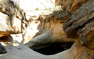
I scrambled down that way far enough to see the natural arch formed by the rushing water and sand.
Once back on the main trail, it was hot, and I was glad to at times walk in the shade of the high canyon walls. In places there was still some damp mud, looking a lot like melted chocolate. I was getting hungry too. Found these little lizard tracks in the chocolate - I mean mud.
The hike was about 3 miles round trip I think. I felt hot and sweaty but great. I'm definitely ready for a "moderate" hike.
Back on the road a sign pointed out the Golden Throne, which I'd missed on the way in.
As I've noted before, the reverse direction often reveals something new.
Well, this is probably the final view of Capitol Gorge. It's been a great visit. Tomorrow, on to Moab for more adventures. Come along...


No comments:
Post a Comment
Want to leave a comment?