Continuing with the pursuit of new and adventurous hikes, here is an exploration of the Chinle Trail as far as the foot of Mount Kinesava. Rick is learning the names of the geological formations we are seeing around here, so I'll include a bit of that. Mostly I was just impressed with the beauty and the peace of the places the trail took us.
The trail begins at Anasizi Way, a "private" road on the east side of Rockville, Utah. Coming from the west on Rt. 9, it's an easy left turn to miss, but the real doozy comes at the first right off of Anasazi Way. There is a sign pointing to the right, indicating the Chinle Trailhead, but there's no way anyone in their right mind would make that turn without knowing what to expect. So the first time I went, I stopped the car, put on the parking break and got out to see if there really was a road and not a cliff there below the hood of the car. Sure enough, there is and you just have to creep over the crest blindly and hope it's there. Trust me and go real slow.
From the parking lot, the trail begins at the information sign and winds it way up a hill, zig-zagging and crossing Anasazi Way again further up. Anasazi Way accesses a beautiful group of adobe homes on what I assume is Anasazi Plateau. (I'll say more about them later.) It also accesses some bike trails on BLM land.
The trail is well marked in some important places, and clear enough as it meanders through the rocks on the edge of the plateau. You just have to pay attention.
You start getting some really good views of the major landmarks of the Zion canyon behind you, and some kind of long views down to the road below. This first part is all rocky, and I was glad to have my walking stick with me to help with a few scrambly places. Below is a particularly swirly stone wash that the trail criss-crosses for awhile.
After passing all the homes and crossing over the road for the last time, this breath-taking view opens up, with nothing between you and Mount Kinesava. At this point the mountain itself is still probably a mile or two away.
Along the way you pass an abandoned corral from the time when
this was still ranch country (before the houses were built here).
Eventually the trail goes almost to the foot of the mountain and you get a good look at what's called the Chinle Formation, after which this trail is named. It's the purple layer at the bottom. This is one of the few places around where you can actually see the purple Chinle rock.
Although the trail goes on to join the Coal Pits Wash Trail, we decided this was far enough for today. My goal is to make the Chinle-Coal Pits Wash loop before we leave. (That's a bit over 10 miles, so I'll have to work up to it.)
The return trip offers more opportunities to see these homes on the plateau. So here's my opportunity to share my enthusiasm about this "pueblo revival" architectural style.
These homes are grand, million dollar versions of the adobe style house, which in its original form was modeled after the Native America pueblo home that was needless to say, much more basic. The style is typically walled with adobe in natural colors, flat roofed, and detailed with rough lumber and log. You can see an authentic pueblo in my post about Taos, NM. But whether grand or not, the style retains a low-profile that blends in with the environment. It's an aesthetic I love.
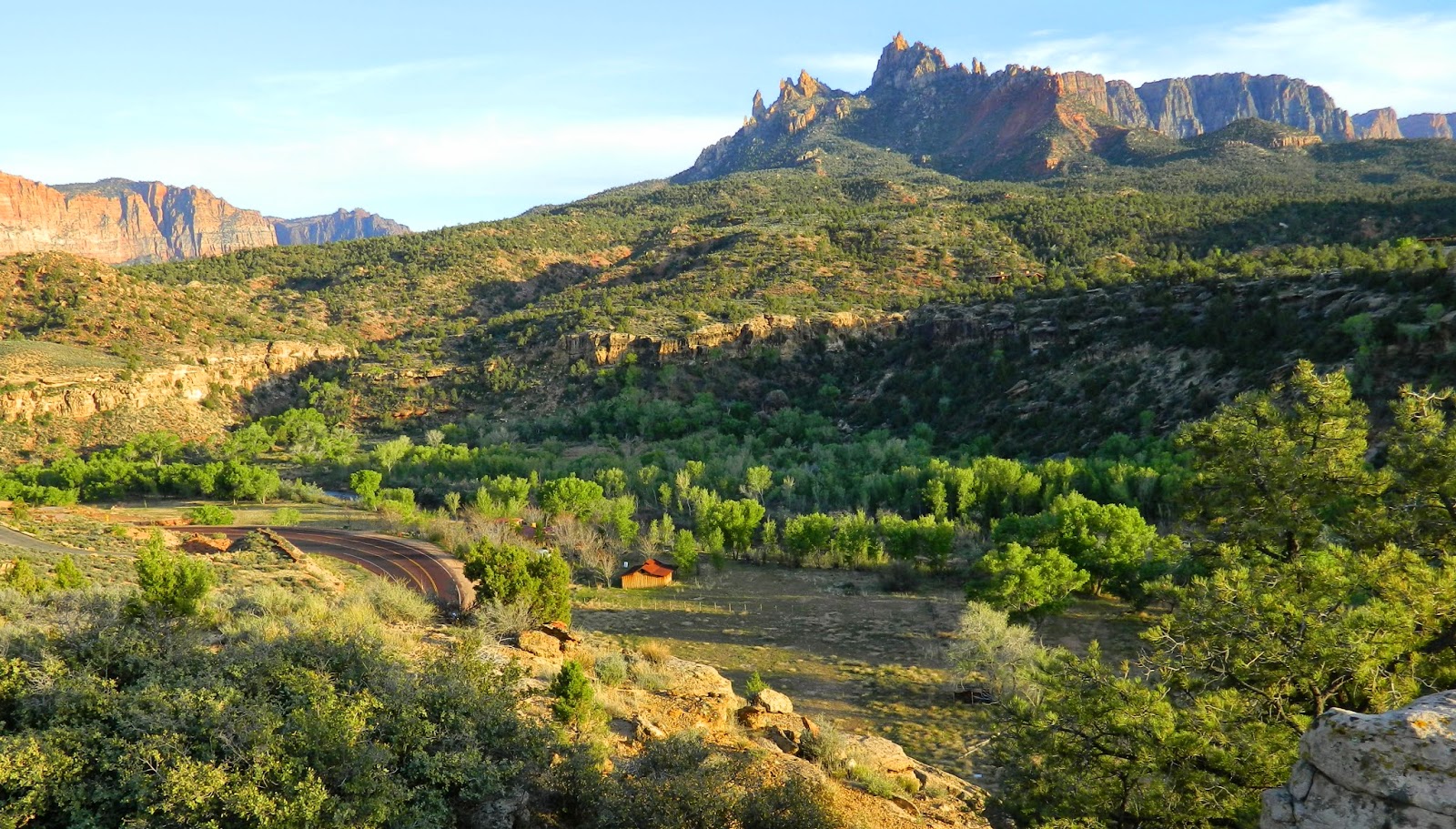
Here is Eagle Crags in the distance, and Rt. 9 below winding its way through the Virgin River valley, lined with cottonwood trees.
The whole hike, from the trailhead to the first wash under Mt. Kinesava took about 2.5 hours and was "easy" to "moderate." I've heard that if we had pushed on a bit further we'd have reached the Petrified Forest area. I'd like to see that too, but this was the perfect hike for now.
Come back for more adventures in beautiful southern Utah. We'll be here for three more weeks. Wishing you a happy Spring and a warm Easter!


No comments:
Post a Comment
Want to leave a comment?