"Could I have this dance for the rest of my life?" - Anne Murray
Showing posts with label Cailfornia. Show all posts

Tuesday, November 4, 2014

Little Petroglyph Canyon

About 45 miles north of the desert California town of Ridgecrest, hidden in the confines of the China Lake Naval Air Weapons Station (which happens to be larger than the state of Rhode Island) is one of the best preserved and most extensive examples of Native American petroglyphs in the country.  If you want to see it though, you have to go through quite a rigamarole via the local Maturango Museum and the U.S. Navy. As I'm sure you can imagine: if it's governmental, it's complicated. 

Once you've jumped through the hoops and reserved a spot on one of the tours, gotten up before dawn to meet at the museum, carpooled with other excited folks, passed through a complete inspection of the vehicle, shown your legal ID and auto paperwork, and wound your way through the twisting-turning dirt backroads of the Naval Base, you will finally arrive at Little Petroglyph Canyon for a real feast for the eyes and imagination.  Phew!

Every tour is accompanied by several highly informed volunteer tour guides. Here's Tom, one of ours. I tried to stay close enough to him throughout to hear what he had to say about all we were seeing.  Here he's telling us about the little dots above the heads of some of the figures, symbolizing power. 


There are hundreds and hundreds of petroglyphs in just this canyon alone, and there are many other canyons with petroglyphs out there as well. This however is one of only two (I believe) that are accessible to the public.  Here's another one our guides and a view of the canyon.


In some places the canyon got kind of narrow and required scrambling over dry volcanic rock waterfalls. The guides were very helpful in those spots, if help was needed. Even without the petroglyphs the three mile (round trip) hike would have been interesting.


There were two groups out there that morning. We got a little backed up at times as some folks needed to navigate the dry falls a little more slowly than others. There were some visitors who opted not to negotiate the dry falls at all and stayed back to see what they could closer to the canyon entrance, and there was plenty to see. The speedier types quickly passed by and were on their way down the canyon in the blink of an eye. Except for those few times it never felt over-peopled, and didn't interfere with viewing the petroglyphs in any way. 


Now, for the petroglyphs themselves. Most of what is "known" about them is hypothesized by various experts, and the subject matter, artists and ages of the glyphs are still in question.  The most ancient are thought to be as old 3,000 years.  Some think they are made by the ancestors of the local Paiute-Shosone tribes, other hypothesize that they are an altogether different group. It's possible they were made by several different groups of people as they were created over a very long period of time and have clearly different styles and subjects.

Many images are anthropomorphic, that is of human-like shapes. Some are identified now as "shaman" figures because they are highly complex and uniquely decorated, looking like they are dressed in ceremonial regalia. Others are humbly human (center and right below), with a few exaggerated features, like arms, hands or feet. In the bottom left is what looks like a 1:1 bow and arrow battle.


This one is known as "Bad Hair Day" by the frequent visitors.


Many others are abstract, or symbolic of unknown subjects, many one of a kind.  Enthusiasts like to hypothesize about what they represent, but it's all guess work. 


I think that by far the most commonly depicted are animals, especially long horned sheep. But there also seem to be a few mountain lions, deer, dogs, thunderbirds/eagles and maybe rabbits and turtles. Who knows?


In a few places there are images of what are thought to be "medicine bags."  It's interesting how things are often represented in collections, possibly returned to over time and recreated there for some reason.


There are quite a few "atlatl" collections. The atlatl is a spear throwing device, the hunting weapon used before the bow and arrow. The bulb-like object in the center of the all the atlatls (below) is supposedly an exaggerated rock that served as a counterweight.


Of course no one knows why the rock is made so much larger than it would be in the actual weapon, (if that's what it is at all) but there seems to be clear agreement among the artists about what it should look like.  (The images seem to be of only the atlatl, without the spear part.) Why are there no bow and arrow collective images?


This is thought to be a picture of a man hunting with an atlatl. It's the only picture of its kind. The descending wavy-lined image below him supposedly represents rain. It's one of the more commonly seen symbols.


Some interesting anomalies can be found as well, including this singular image of a human footprint...


…and this modern petroglyph. It was actually made by a scientist participating in the development of US nuclear weapons at this site during WWIII. Interesting how "primitive" his artistic methods are compared to the older petroglyphs. Was it meant as a joke, or a profound statement of one of the most powerful symbols of our time? It too is now protected as one of the historic petroglyphs, even though it's only about 60 years old. 


It was a fascinating day, and I recommend the outing to anyone who's interested in anthropology, history or art. It's a real eye-full and so thought provoking.

Friday, October 10, 2014

Eastern Sierras Part Two: Mono Lake


Based on the eerie, otherworldly photos everyone has seen of Mono Lake, I was really looking forward to witnessing it for myself, and attempting to take some photographs as well. We arrived at The Mono Basin National Forest Scenic Area Visitor's Center at midday - not great for taking pictures, but we were excited to see it any time of day.  There is a smallish section of the shore near the Visitor's Center on 395 just north of Lee Vining, sporting the tufa towers that are the focal point of most photos of Mono Lake.

We drove down to the picnic area on the northwest shore and ventured out toward the tufa.  It looked unusual and interesting from a distance.


But as we tried to get closer we found ourselves slipping and sliding in the mud. You can see the footprints of others who tried the same approach in the picture below.


Our hosts at Meadocliff KOA in Walker had told us that the best place to view the tufa was on the south shore, and they were certainly right. Called the South Tufa area, it is accessed via Rt. 120 about 6 miles south of Lee Vining. There is a fee to access the area, collected by the National Forest Service at the parking lot. (National Parks Senior Passes apply!) 


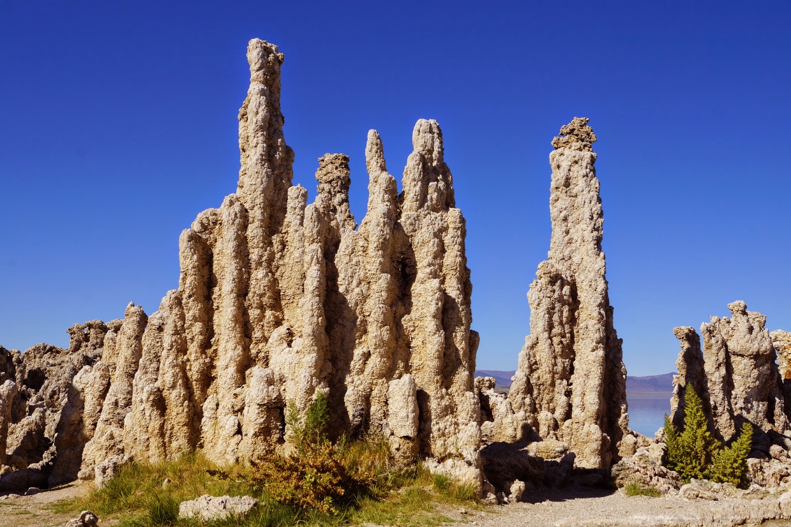
A boardwalk and a nature trail lead to the shore where there are acres of tufa, ranging from these mini-mushroom types, about a foot tall…


…to towers almost two stories tall.


Tufa is created when spring water rich in calcium emerges under a body of water rich in carbonates, resulting in underwater towers of calcium carbonate.  (They remind me an awful lot of those multicolored magic rocks we used to get as kids, that you dropped into a small plastic tank, and they bubbled up and created little multicolored mountains. I wonder if its a similar chemical process. The result are sure similar, except for the color and size of course.)


The trails wind around among the tufa towers and along the shore. The towers in the water are the most recently exposed, while there are acres of towers in amongst the grass and sage brush that have been exposed over the years as the level of Mono Lake has declined.  


Yes, the water level is down, as Los Angeles taps the streams that would normally maintain the level of the lake.


An environmental movement led by the Mono Lake Committee has achieved a miraculous agreement with the California State water-powers-that-be to restore the level of the lake to it's 1982 mark.  This will take time, and the drought is making restoration slow.


I went back to the lake at sunset another day, still trying for some of those magical photographs.  It was a full moon night too. When I arrived, the shore was completely colonized by the largest flock of photographers I have ever witnessed in one place. Every photogenic spot was already staked out with tripods. I wandered around feeling left out, uninspired and considered packing it in. 


But I just kept wandering and looking, hoping for inspiration and a clear shot of something - anything!


Luckily I found a little out of the way corner of the shoreline and saw some interesting light and formations, and started snapping. I wrangled with the tripod for awhile and then gave up. The low light is obviously a challenge, and a tripod would have helped a lot.

You know, the tufa is not beautiful, it's kind of gnarly and crumbly and frankly, ugly, but it does make for some unusual focal points in contrast to the water and sky.


I'd say the results are not inspirational, but they're at least memorable and will give you a sense of what its like at Mono Lake.


I think I was the last photographer in the area, without even a flashlight! Fortunately there was just enough ambient light in the sky and from the full moon to guide me back to the parking lot.


Thursday, October 9, 2014

South on 395 Through the Eastern Sierras: Part One

Our journey through the Eastern Sierra Nevadas really started in Lake Tahoe, but connectivity has been sketchy, so we're starting here now, with high hopes of being able to continue a series.

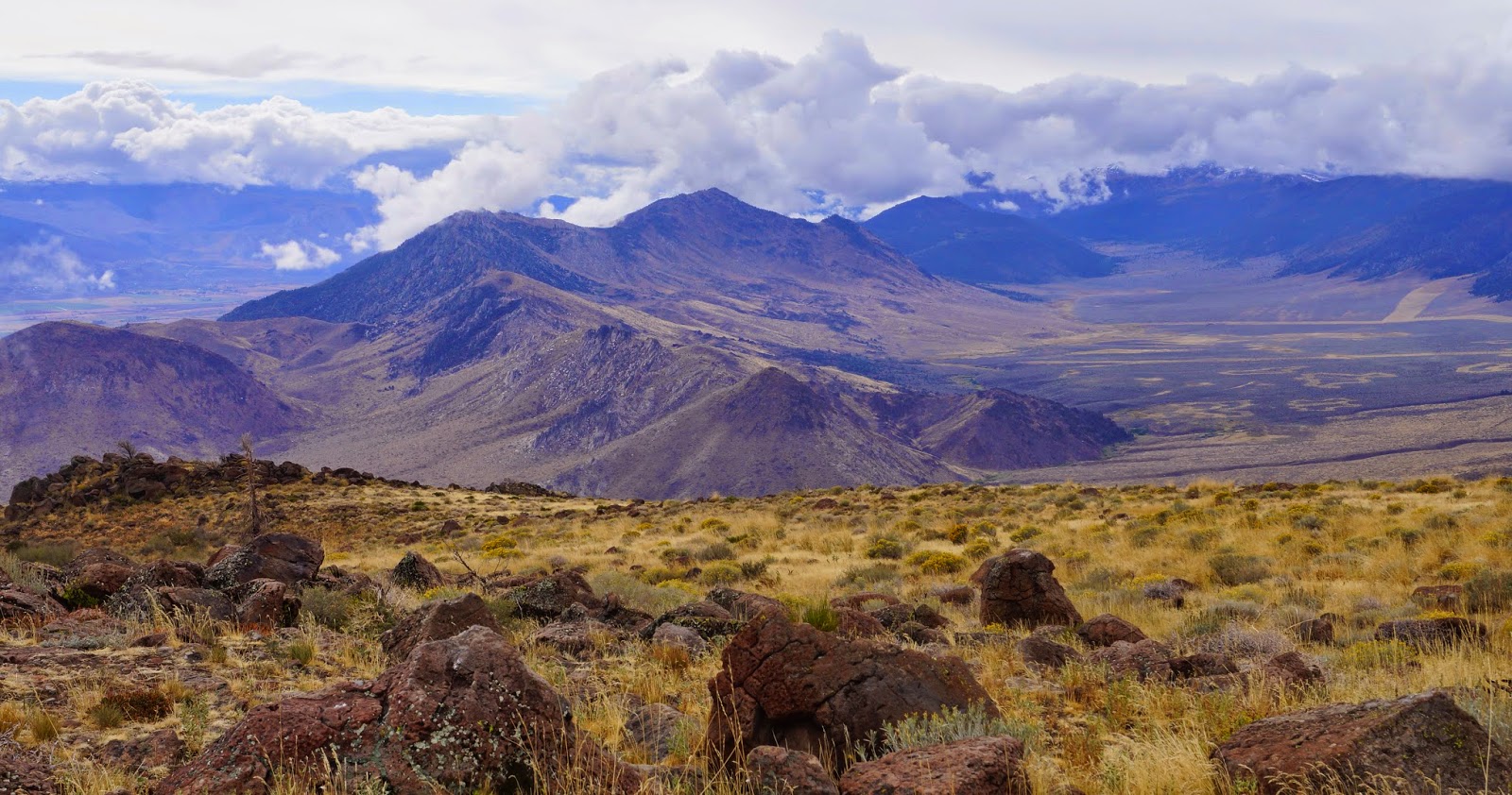
Here on the eastern side of the Sierras, it looks much like Nevada - a dry, near desert landscape with various mountain ranges surrounding the wide valleys that makes up the Great Basin.


Early morning on Golden Gate Rd., Walker, CA

At the moment, "here" is Lee Vining, California, the town closest to Mono Lake. "Then," a couple of days ago, was Coleville/Walker, CA. I'll just take this post to revisit our travels based out of there. We parked at the Meadowcliff KOA, right between Coleville and Walker, in beautiful Antelope Valley. The campground and motel have just recently joined the KOA gang, so you know what that means about the price. But the owners are taking great care of the place, doing much landscaping and rearranging. Everything is very clean and pleasant. It's nestled at the foot of a massive cliff that provides much appreciated late afternoon shade, and catches the early morning light too.

It's a sparsely populated area, devoted mostly to ranching and fishing on the Walker River, renown for its trout.  Both towns are kind of spread out through the valley, so you get very little sense of them being "towns," but there are a few good solid restaurants to recommend. The one right at the Meadowcliff KOA is great for breakfast and lunch (try the cinnamon rolls), and the Mountain View BBQ is a friendly hangout that serves up some yummy BBQ, coleslaw and local Mammoth beer at dinner time. Say Hi to Jeff for us if you stop by. Also the Walker Burger is a classic. All three are very homey and seem to be run by people who care a lot about the quality of their establishments, food and service.

We were in Walker for a little over a week and made a bunch of day trips.  On the first morning I was up at dawn to explore the area. After checking out Mill Canyon and Golden Gate Roads in Walker, I ended up at the Topaz Lake Recreation Area where there is a campground, a boat launch and a few trails to hike.


Topaz Lake

One day we drove Monitor Pass/Rt. 89 from Topaz Lake over to Markleeville...

View from Monitor Pass

...and on to the Grover Hot Springs State Park. The hot springs are channeled into two concrete pools, one hot and one not. There are showers, restrooms, dressing rooms, and a small admission fee. After a quick soak we drove to Gardnervile and Minden, NV, the closest cities with grocery stores, car washes, barber shops and hardware stores to do errands. 

(Side note: Every time you cross back into California from any other state, you have to pass through these check points where they are supposedly looking for produce that might carry pests from other states. But we can't figure out what they're really looking for. Sometimes they ask where you're coming from, sometimes not. Sometimes they ask if you have any produce, but when we showed them a list of the produce we had in the RV fridge, they said "What's this?" and acted like they had no interest in our fresh produce at all. Another time they asked if we had any houseplants. Honestly, I have no idea what they're after.) 

Another day, we travelled south to the ghost town of Bodie State Historic Park and enjoyed a very different kind of photographic experience for us. Bright midday sun threatened to bleach out everything, but the colors of the aged wood, rusted metal, tin roofs and siding, and the bright blue sky came through anyway.


One day we drove the high and dramatic Sonora Pass/Rt. 108 from Bridgeport to Dardenelle. What amazing scenery.

Looking east toward the Sweetwater Mountains

"Columns of the Giants" lava formations
 Once you get up into the mountains, and cross over the passes, you leave the Great Basin and the terrain changes to support large evergreens such as sugar pines, Jeffrey and ponderosa pines. The landscape is crisscrossed with streams and dotted with mountain lakes. This is the classic rocks, trees and water triumvirate of the Sierras.

Sardine Falls it the distant center (I think)

Walker River, above Leavitt Falls

Stanislaus River

I topped off our week with a hike to Roosevelt and Lane Lakes via Leavitt Meadow Trail (off of Sonoma Pass/Rt. 108). Sometimes I do these longer hikes alone and take along my Personal Locator Beacon. I got lucky this time and met a nice guy named Kevin who I walked with almost all the way to the lakes.  Often these chance meetings work out well. For the most part, I think hikers are friendly, interesting, and interested people, who are happy for company even if they start out hiking alone (like me!). 

Leavitt Meadow Trail

The trail starts at Leavitt Meadows, and then ascends up through the typical large rounded rocks and evergreens of the Sierras. The scattered groves of willows and aspens had just turned bright gold this week. Eventually there are at least four lakes along or near that trail: Roosevelt,  Lane, Secret and Fremont. Lots of hikers go up to camp and fish for several days. I just went about 4 miles to the second lake, which I think was Lane Lake.

Roosevelt Lake

I had the lakes pretty much to myself once I got there. 

Lane Lake

Perfect place for a picnic lunch before heading back down. 

Roosevelt Lake


So, now we've caught up to Lee Vining, where we have easy access to Mono Lake, and the grandest pass of them all: Tioga Pass/ Rt. 120.  For my next post...


Tuesday, September 30, 2014

Beautiful Lake Tahoe

*#*?#!*#*&#?!

OK, that's all the fuming I'm going to do about the internet and AT&T cell service we've been getting as we travel south along the eastern edge of California. It is truly beautiful country around here, and we have loved everything about it except the electronic connectivity. It took me 30 minutes to upload three pictures from Lake Tahoe - a place where Rick and I took literally hundreds of photographs of incredible scenery. So, although I can personally live without phone, internet and television for a long time, it makes writing blog posts almost impossible. I apologize for the scarcity of my communications. 


We've heard about Lake Tahoe so often from those with more experience in the western USA, but this is the first time we've witnessed its beauty for ourselves. Whatever rave reviews you've heard, they are not an exaggeration. It is truly a spectacular place. The lake itself is breathtaking and the surrounding mountains are dramatic. The relationship of water and rocks is at its best here. 


Yes, there are parts of the surrounding area that are built up in a less than attractive manner, like South Lake Tahoe and parts of Zephyr Cove, with casinos making their ugly appearance.  But other than those two areas, we thought the development was very tasteful. We know the locals and old-timers in the area mourn the pristine conditions, but as newcomers, we were still impressed with the natural beauty of the lake and shoreline communities.


We are currently in Coleville (or maybe it's Walker) CA and are working our way down Rt. 395 through remote areas of the Eastern Sierra Nevadas. Yesterday we visited Mono Lake and today we're heading for Bodie, arguably the largest and best preserved "ghost town" in the country. We'll be in touch as we can. 

Monday, March 26, 2012

Finally Dancing!

One of our intentions, the one that inspired the name of this blog, was to find contra dances across the country as we traveled. (See the page in the right hand column of the blog if you're unfamiliar with contra dancing.) Well, in reality they have been few and far between. As hard as it is for us to believe, there are not contra dances everywhere!  Dancing was especially dry in Montana, South Dakota and Utah. Many dances also take the summer off.

So, down in Southern California we finally started to run into some dances again. We found one in Brentwood, near LA, and then another in San Diego. Now, up here in and around San Francisco there is a thriving contra dance community. On Saturday night we danced in Palo Alto, with caller Jean Corrindo and dynamic music by the Rosin Doctors.

Then on Sunday afternoon we attended a lively dance in Hayward with Susan Kendig (from Portland, OR) calling and Triangularity (from Seattle) providing the music. Great crowd, friendly people and quite a feast of snacks at the break. Thanks to Michael and Lenore (yes, the first one I've ever met at a contra dance) for your welcomes and wealth of information about local dances up the west coast.

As we head north through California and on to the coasts of Oregon and Washington we expect to run into more dances along the way, especially in Portland and Seattle. So we are really dancing across the country now. Or maybe up the county.