"Could I have this dance for the rest of my life?" - Anne Murray

Thursday, April 4, 2013

How We Plan Our Travels


A lot of the people we meet on our travels ask us how we make our plans. As our Internet mentors on RV Dreams have said, “There’s no one right way to full time.”  Some people always wing it and make no plans or reservations, but we do make plans, and in this post I’ll explain how.

(Why do we make reservations? Well, I just can’t imagine dismantling our temporary home, driving some distance and showing up somewhere only to find there is no site, or only a crummy one, and then having to find another place. It just sounds exhausting and stressful. Why not make a reservation?)

OK, first the overview: We are not seasonal travelers, so we are not in any particular repeating pattern. It’s all new to us, which is exciting and also kind of labor intensive at times. The planning work is divided between us.  I create a draft itinerary for a few months out, Rick looks it over and offers feedback. When we basically agree on our stops, he plans the details of the actual detailed route we will drive to get to those places.

Now the nitty gritty, if you’re interested.

My first step is to look at a big map of the US in a large paper atlas I’ve been using since we started full timing. I have been highlighting all the places we’ve been and the routes we’ve travelled. By looking at the big picture I can sketch out a rough plan of where we might like to go.  Fortunately we are pretty like-minded about where we want to go.

I then look at the state maps in the atlas and sketch out general routes through the states we’re considering.  If there are very popular areas we want to visit in high season, I jump to those locations many months ahead of time to select a place to stay, maybe for a whole month, and contact those places to make reservations. Then I set to work filling in the details up to, or between those long-term reservations. (We like to stay places for a month when we can, but in between those places, we often need to make many stops.)

My next step is to go to the website RV Park Reviews. By the way, RV Park Reviews is basically the only directory I use.  It's reliable, user friendly, bug free and has a wealth of the kind of information we need. Sometimes if I’m really stumped I’ll check in with Big Rigs Best Bets, RV Dreams, We Called it Home, Wheeling It or RVersOnline for their recommendations. I very rarely use the KOA, Passport America, Good Sam or Woodall's guides, even though we are members of the first three for their discounts. I just don't find their listings very informative or useful.

On RV Park Reviews I start by looking at the towns we are passing through along the general route I’ve drafted. If there are particular places we want to visit, like a national park, botanical garden, or friends/family, then I start in the towns closest to those places. RV Park Reviews lets me pick a location either on a state map or from a list of towns in a given state. If there is nothing I like in that town, it will show me the next closest towns that have RV parks, and in what direction they are from the original town.

Each campground is listed with links to its website and a live Google Map of its location from which you can zoom in or out and select map or satellite view, as usual on Google Maps. There is a series of shorthand guest ratings of the park overall from 1-10, a basic check list of amenities, and many detailed reviews written by campers who have stayed there.  The first thing I look at is the series of 1-10 ratings. If there are lots of 8,9 & 10s then I look further. If there are not, I don’t bother.  At this point, I read the reviews. What I am most concerned about is if the place is really big rig accessible, if it has full hook-ups, and any red flags that folks may mention, like no cell phone service or sites too close together.  If all seems OK I look at the map to get a sense of its location (not in the middle of an urban area is good), the lay out of the park and if the sites are clear enough of the trees to get a satellite signal. If that all checks out, then I go to the park’s own website. On their website I’m looking for photos of the park, their rates, and the overall feel or quality.  We’re looking for big enough sites, pull-throughs if possible, full hook-ups with 50 amps, and room to park both our vehicles in our site.  Extra good things are natural bodies of water, pools, hot tubs, biking and hiking trails, nice landscaping, access to nature, and nearby points of interest. 

Once I’ve selected a park it goes on the draft itinerary, becoming a one in a series of stops, each about 1½ to 3 hours away from each other. I keep a draft itinerary going as a Word document that I can tweak as our plans evolve, with the date, name of the town and the rv park, its address, phone number and a live web link. That itinerary also serves as a record of where we have been and when.  

When a draft of the next few months is complete I email it to Rick, who looks it over and approves or makes suggestions.  Of course during the creation of this draft I have been talking to Rick about it to get his general opinion about our direction, so it’s not a surprise when he gets the itinerary email. If he approves the plan, I make reservations by phone for the next few locations, being sure to ask for a pull-through and a clear view of the sky for satellite if possible, and continue doing that as we travel, just a week or so ahead of ourselves.  (The exception is the reservations I've made months ahead for high demand times and locations.)  I also put all our confirmed stops and reservations in my iphone calendar, with addresses and phone numbers.

About a week or so before we are about to move to a new location, or a series of locations, Rick creates a route on Google maps. He looks at every detail of the route in both satellite and map versions, to avoid any problem spots, like low railroad bridges, switch back turns, or tunnels.  He also prefers four lane highways, especially in the hilly states, but not necessarily interstates. It’s a drag to drive along a two lane highway with car traffic building up behind the fifth wheel, especially if there are no pull offs, as is the case in some states. When he is satisfied that the route is safe, he prints out turn-by-turn copies for each of us.  The night before we travel we each review the route by looking at Google Maps live again, just so the route is familiar and fresh in our minds.

The day of our move, because we drive two different vehicles, we each have our printed routes, I have my atlas, and we use turn-by-turn navigation on the Google Maps App on our iphones as a GPS.  We use walkie-talkies to keep in touch as we drive. I lead the way, and act as a scout for Rick, as he pulls the fifth wheel. If we get off course, we use Google Maps to help us find a new route. I also double-check our location on the live GPS map in the dash of the Subaru. (I don’t use its directions; we’ve found them to be inadequate.)

So that’s basically how we do it. It's a nice team effort and is part of what makes this adventure as fresh, fun and satisfying as it is.

Tuesday, April 2, 2013

Kayaking the Ichetucknee River

Well, my fantasy Florida experience finally became a reality. I've been looking for the perfect clear, spring fed river to kayak on, and after many close calls we finally found THE ONE. (I'm sure there are others, but this is ours, for now.)  

We are camped at Ellie Ray's RV Resort on the Santa Fe River near Branford, FL, in the heart of spring country. While we were setting up, the park owner "Sturge" dropped by to see if we were doing OK or needed anything. While chatting we mentioned that we were planning on putting the kayak in the river, and he said, "You've got to do the Ichetucknee." 


We did some research and discovered that it was very close and very accessible. Ichetucknee Springs State Park protects the headspring and upper Ichetucknee River and regulates its use. In the summer the "Ich" is wildly popular with the tubers, and is often maxed out, with lines of people waiting to get in the water. In the winter, much of it is closed to tubers to give the river a chance to recover, but remains open to canoes and kayaks. Yeah!!! In the summer they also have trams that take tubers back to the parking lots from the last take out point. We just parked Ms. Subaru at the North launch and intended to paddle all the way back to our campground, about 6-8 miles downstream, then come back with the truck to get her. Below is the map from the State Park website.


The night before, we drove up to the North Entrance of the park to scope out the situation, and were advised by the park ranger as to how to proceed the following day. She let us drive down to see the launch and take a peak at the Head Spring and the Blue Hole. Unfortunately we didn't have our cameras with us. There was about a half mile hike to the Blue Hole, which is over a spring vent that comes up through a series of deep caves popular with divers. Swimming is allowed there, and a few intrepid youngsters were jumping in and looking down into the hole with their snorkel gear.  We both agreed that these two spring swimming holes were the best we'd seen so far.

After exploring around the park a little, and locating the launch area, we went home to prepare for a big next day. Little did we know how big it was going to be!

The launch area has this neat platform a couple of feet wide to assist putting in your boat. I'm standing in the ankle deep water here, getting ready to put in. The water was gloriously clear and a comfortable temperature.  We got our kayaks in with only one of us, who will remain nameless, getting dumped into the springs. 


Here's Rick in the river, in his kayak.


As you can see, the water is just dreamy. This is what I've been looking for.  It's so clear that you can see all the fish and turtles swimming along with the white sand or pale green water grasses behind them.


In some places the upper river is very narrow and winding, and you have to be alert so as not to end up in the cypress knees or grasses that line the river. In other places it opens up. It was in places like this that Rick spotted otters a couple of times. 


We passed the Midpoint Dock and then got out for a little break at Dampier Landing. It was a bit of a hike to the restrooms, but it felt good to stretch our legs.


Along the Ich we also saw lots of turtles and birds (a couple of swallow tail kites!), maybe a manatee, but no snakes or anything else that felt dangerous. It was very peaceful.


The Ich leaves the State Park and passes through a residential area, where the homes have these boardwalks and wooden decks quite a ways from the house, to accomodate the fluctuating water level. The water was very high and most of the docks were flooded.  We didn't see a single person on the river until we were almost to the Santa Fe River, the next leg of our journey.


Now, I had assumed that this would trip would be pretty easy becasue it was all downstream, and we would be protected from any breezes by the trees that line the whole river. But once the Ich meets the Santa Fe, it is much wider, and unfortunately, the wind picked up and seemed to be blowing right up the river.  Because the water level was so high, there was almost no current (1 mph the website said).  So, we were paddling against a head wind, with almost no current to help us along. Needless to say, I stopped taking pictures and just focused on paddling, paddling, paddling. Sometimes I got into a rhythm and it wasn't too bad. Other times I was feeling pretty whiney and wishing a knight on a jet ski would come rescue me.  But I tried to keep up and not be too grumpy.  


Six hours later we pulled into our campground. Knowing what we know now, we both agreed we would have been happy to just do the Ich from the North Entrance to the last downstream take out landing in the park, and skip the Santa Fe completely. The part of the Santa Fe we paddled was not all that special anyway. 

Despite minor travails, I do feel grateful that we didn't get rained on, and that the Ichetucknee was the most beautiful paddle of my life. Now I can leave Florida feeling happily satisfied, if we ever get out of here.  More on that soon.


Monday, April 1, 2013

Florida's Nature Coast III: Cedar Key

We had planned on staying at the Cedar Key RV Resort for a month, but due to needed repairs, we ended up at The Great Outdoors for that month instead. We still wanted to visit Cedar Key, so we are here for just three days. It's a very nice, lightly wooded park in a rural area about seven miles from Cedar Key. The sites all have very large grassy spaces around them, concrete pads with asphalt aprons and full hook ups.  There are laundry facilities on the main buildings porch (that's a first!), very clean new bathrooms, a large multi-purpose club house with full kitchen, and a large, sparkling pol. The managers are very pleasant and helpful.  I'd recommend it to anyone, except maybe a family with kids who want activities. I also think it would be a great place for a rally.


Pre-dawn at Cedar Key RV Resort

Our first morning here I got up before dawn and drove into Cedar Key proper and situated myself in a spot where I thought I might catch the sunrise.


Pelican just before dawn.

Success!

A black skimmer at sunrise.

While pulling out of my morning photo spot I caught this osprey near her nest, also taking in the sunrise.


Just before downtown proper, I stopped at Kona Joe's for a cup of coffee and a pastry. They have a back porch overlooking the water that also would have been a great place to watch the sunrise.


Fishing decor at Kona Joe's

The town of Cedar Key used to be primarily a fishing community, but as a result of the gill net fishing ban they have had to change their economic reliance to tourism.  The town still depends on the ocean for its livelihood in many forms, with homemade signs along the road for fishing guides, smoked mullet, mullet dip, oyster, crabs and clams.  Many fisherman are now clam farmers, who got their start with support from government agencies that introduced the science of clam farming to the area.

Cedar Key seems proud of its history, retains much of its old charm, and has no chain stores, chain motels or chain restaurants - so unusual  The old downtown area is the most interesting, but I can't tell how business is doing there. There is a famous restaurant that draws a crowd, Tony's, which was recognized as having the world's best clam chowder for three years in a row. (We tried it and I loved it. It was a little spicy for Rick.)

There are several historical buildings and older rental homes downtown in addition to hotels, B & B's and a few motels.


The old Hodges House

The old Lutterloh store

A local artsy boutique

The waterfront is busy with clammers, boat tours and recreational boating of all sorts.

Cedar Key marina

Low tide exposes the oysters and barnacles

Horseshoe crab at low tide on Seahorse Key

We took a three hour boat tour of the area with Captain Doug's Tidewater Tours, around a few of the many off shore islands.  The water here is very shallow, making it difficult to navigate at low tide, which is was when we went out. Our captain was very skillful and entertaining, with lots of stories about the sea life around here and the history of Cedar Key.  Near the end of the tour we were graced with a playful porpoise in our wake, escorting us back to the marina.


A view of Cedar Key from the north side of town

The sugar sand town beach


The Captains Table, recently closed

Fishing off the new town dock

It looks like the town has had some destructive storms in the past few years, or else some of the older structures have just collapsed over time.


Scenic ruins off shore

The newer part of town has a few touristy shops, bars, restaurants, etc. It's all very relaxed, colorful and a little funky, like a mini Key West. The town is described as what Key West was like 30 years ago, and I'd say that seems pretty apt.


Manatee drawing the tourists in to this restaurant
The whole of the newer commercial area right on the water
Overall, I'd say that the "Nature Coast" has a lot of unspoiled natural areas and unique smaller towns with just enough amenities for travelers who are looking to get away from the cities and suburbs that are typical of much of the USA. It certainly is different from Orlando.  It's got the fresh water springs, the ocean, a few beaches and plenty of opportunities for nature lovers on land or sea.

Friday, March 29, 2013

Florida's Nature Coast II: Homosassa Springs

Homosassa Springs Wildlife State Park

On the second full day at Rock Crusher Canyon RV Park we ventured slightly south to the Homosassa Springs Wildlife State Park.  Originally a privately owned exotic animal petting zoo, the park was purchased by the state in 1989, and now houses only native Floridian animals. 


Oh, except for Luc, the hippopotamus, left over from the exotic animal zoo. He was very active the day we visited, keeping up a constant circuit around his pool, lifting and shaking his enormous head, and displaying his fine teeth.


While best known for its manatees, the park has a full collection of everybody's favorite Florida mammals, birds and reptiles. We saw river otters, two bobcats, a Florida panther and two black bears, none of which we have seen in the wild around here. But no wild pigs, which we have seen on several occasions.

Of course they had many alligators. No swimming with the alligators? Really?


There was a grand aviary with several ducks we hadn't had the pleasure of seeing before, one being the beautiful fulvous whistling duck (below).


There were also black and yellow crowned night herons, some of which had loud babies stashed in the bushes whom they were feeding. Here's a yellow crowned night heron not on baby duty, taking it easy in the sun...


...and a nice shot of a green backed heron.


Zoos do give you a chance to study animals that you would never see so close in the wild. Here are a couple of crested caracaras. We have only seen them at a great distance before. 


We spent a long time watching the flamingos. It was nesting season, so there was a lot of interaction and unusual behavior.  The park has been trying for many years to get the flamingos to nest successfully.  Flamingos make mud mounds for nests, that keep the eggs and babies up above the tide line. The keepers have made some nests for them, in hopes of stimulating nesting behavior. This year they think it might be happening. We got to watch one flamingo who seemed to be trying to build her own nest. 

These four looked and sounded like they were having a loud, heated and protracted argument. 


In addition to the four resident rehabilitating manatee and countless transient ones, an elegant pair of swans in courting mode, glide around the springs.


Our last stop of the day was the "Fish Bowl," an underwater observatory right over the deepest part of the springs, where the natural fish are abundant. Yes, there were large schools of several kinds of fish, including mangrove snapper, crevalle jack and sheepshead.  The spring is much deeper than it looks from the surface, and is replenished naturally with 6 million gallons of fresh water every hour!


My next post will cover our visit to Cedar Key, a sleepy, funky town on the Gulf Coast, said to be like Key West was 30 years ago.  

Wednesday, March 27, 2013

Florida's Nature Coast I: Crystal River

Rock Crusher Canyon RV Park


This is a two night stop on the first leg of our visit to Florida's "Nature Coast."  Rock Crusher Canyon is a very large campground laid out more like a state park than a private RV park. You don't feel like it's a big park at all, as you can only see a few of your neighbors. The sites are sand and grass, very long and wide, and most are wooded. We're lucky and have a site clear enough to the SW sky to locate the requisite three satellites on our Direct TV dish.  We chose this park based on very high recommendations from several sources, and they were right. It is a comfortable, high quality place with nice amenities, and a great location to visit Inverness, Crystal River and Homosassa, which is just what we did.

Inverness


The town of Inverness has a small historical square around the Citrus County Courthouse (above) and a thriving sprawl just outside of town. In contrast to Titusville its a regular Hilton Head. We started our visit at Liberty Park, on the banks of Cooter Lake, named after the Florida cooter I assume, based on the statue at the entrance. 


The park must be pretty new, with several nice pavilions and a path that looks like it goes around much of the lake.  The Withlacoochee State (bike) Trail also goes right through the park. There were kids fishing and lovers strolling along the lakeshore. Idyllic.


They've got their own 9-11 memorial as well.  I liked Inverness, even though we didn't see a lot of it.


Crystal River

Our explorations of the area took us next to the town of Crystal River on Kings Bay, fed by 30 springs, waterway to the Crystal River National Wildlife Preserve, home to a multitude of manatee. There are plenty of public parks, marinas and boat launches in town to help folks get on the water. It was a windy 57 degrees, so we did our sight-seeing from land.


Roger Goettelmann Memorial Peer with a nifty public canoe/kayak launch on the right

Roger Goettelmann Memorial Peer
Hunter's Spring Park

King's Bay from Hunter's Spring Park

Fort Island

A drive out Fort Island Trail Rd. took us closer to the Gulf, but still not beyond the many islands and salt marshes that line the coast here.  At the end of the long, winding, scenic road there is a boat launch, fishing peer and beach.

The Crystal River Nuclear Power Plant from Fort Island

Fort Island Beach - Pretty, but NOT a beach day

Although there were no people enjoying the beach on this chilly day, the birds were happy.


We saw our first confirmed black skimmers, standing around on the beach, facing into the wind, with royal terns and laughing gulls. (We think we may have seen them before out on Merritt Island, doing their skimming thing, but we weren't sure until now.)


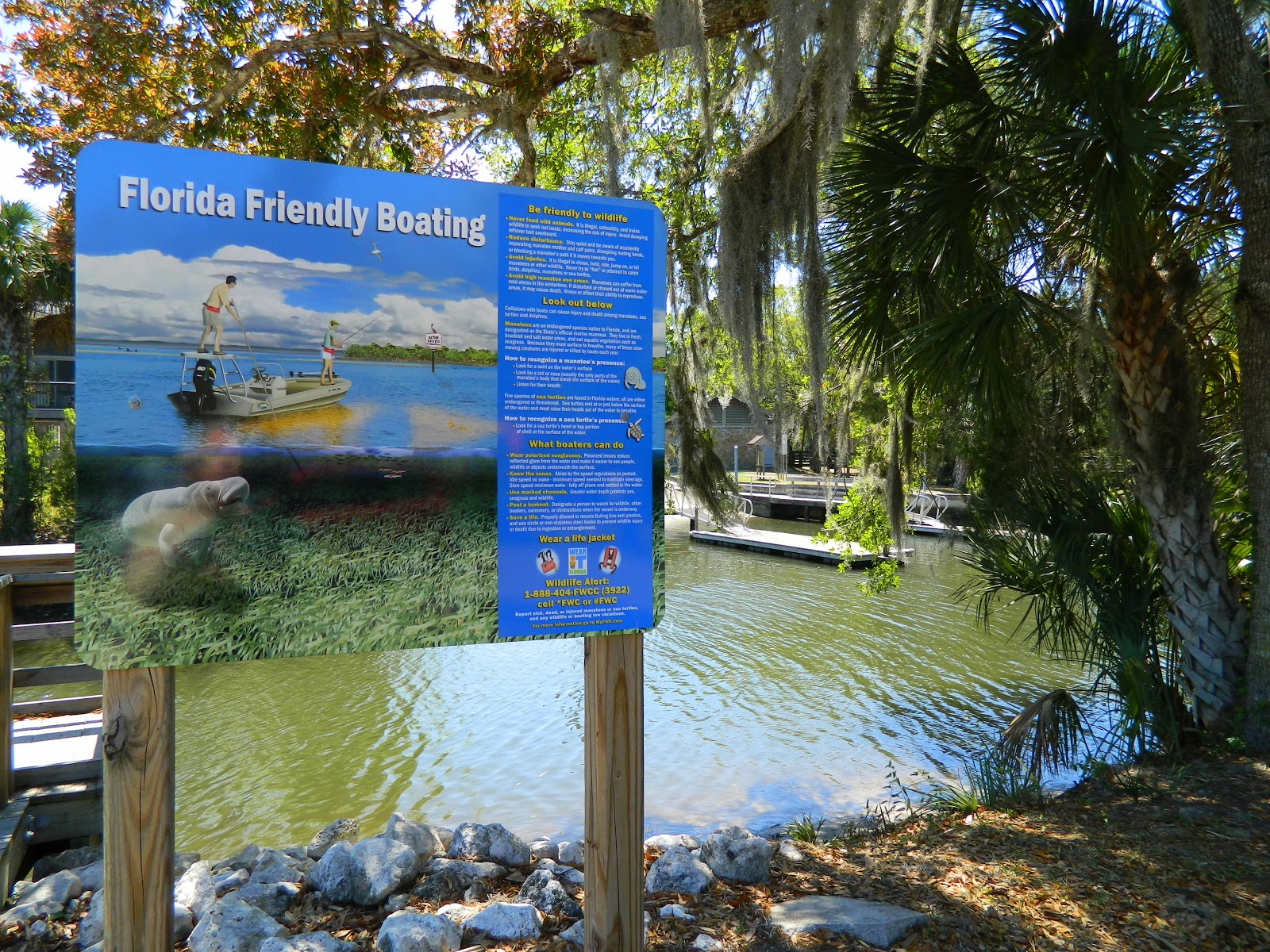
On our way back on Fort Island Trail Road we slipped into the Fort Island Trail Park for a quick look.  It had a picnic area, a boat launch and a reminder about manatee friendly boat behavior.


While we were there some clammers pulled in the canal. (Is that what you call clam fishermen?) They had about ten burlap bags filled with shellfish, that we guessed were clams. ("Hard" clams are seeded and farmed around here.)  

Those cute houses next to the canal seemed to be empty and had "Auction" signs on them. We hear that living on the water is becoming difficult due to rising home owner's insurance costs.


Another view of the canal at Fort Island Trail Park.

Peck's Old Port Cove


For lunch we sought out Peck's Old Port Cove Restaurant, based on recommendations from the internet. It is supposedly a real favorite for seafood. It was in a great location, on Ozella Trail Road, one of these roads that meanders out through the salt marshes and rural neighborhoods, right on to the water. It reminded us a lot of the outlying islands of the Caribbean, except the water wasn't as blue. 

Frankly, I thought the food experience was, well...meh. The place was kind of old fashioned, and not in a good way. It needed a thorough steam cleaning and an updated menu.  The most interesting thing about Peck's was the "crab farm" out back...


...and the crabs.


Next post, Homosassa Springs Wildlife State Park.