"Could I have this dance for the rest of my life?" - Anne Murray

Tuesday, November 4, 2014

Little Petroglyph Canyon

About 45 miles north of the desert California town of Ridgecrest, hidden in the confines of the China Lake Naval Air Weapons Station (which happens to be larger than the state of Rhode Island) is one of the best preserved and most extensive examples of Native American petroglyphs in the country.  If you want to see it though, you have to go through quite a rigamarole via the local Maturango Museum and the U.S. Navy. As I'm sure you can imagine: if it's governmental, it's complicated. 

Once you've jumped through the hoops and reserved a spot on one of the tours, gotten up before dawn to meet at the museum, carpooled with other excited folks, passed through a complete inspection of the vehicle, shown your legal ID and auto paperwork, and wound your way through the twisting-turning dirt backroads of the Naval Base, you will finally arrive at Little Petroglyph Canyon for a real feast for the eyes and imagination.  Phew!

Every tour is accompanied by several highly informed volunteer tour guides. Here's Tom, one of ours. I tried to stay close enough to him throughout to hear what he had to say about all we were seeing.  Here he's telling us about the little dots above the heads of some of the figures, symbolizing power. 


There are hundreds and hundreds of petroglyphs in just this canyon alone, and there are many other canyons with petroglyphs out there as well. This however is one of only two (I believe) that are accessible to the public.  Here's another one our guides and a view of the canyon.


In some places the canyon got kind of narrow and required scrambling over dry volcanic rock waterfalls. The guides were very helpful in those spots, if help was needed. Even without the petroglyphs the three mile (round trip) hike would have been interesting.


There were two groups out there that morning. We got a little backed up at times as some folks needed to navigate the dry falls a little more slowly than others. There were some visitors who opted not to negotiate the dry falls at all and stayed back to see what they could closer to the canyon entrance, and there was plenty to see. The speedier types quickly passed by and were on their way down the canyon in the blink of an eye. Except for those few times it never felt over-peopled, and didn't interfere with viewing the petroglyphs in any way. 


Now, for the petroglyphs themselves. Most of what is "known" about them is hypothesized by various experts, and the subject matter, artists and ages of the glyphs are still in question.  The most ancient are thought to be as old 3,000 years.  Some think they are made by the ancestors of the local Paiute-Shosone tribes, other hypothesize that they are an altogether different group. It's possible they were made by several different groups of people as they were created over a very long period of time and have clearly different styles and subjects.

Many images are anthropomorphic, that is of human-like shapes. Some are identified now as "shaman" figures because they are highly complex and uniquely decorated, looking like they are dressed in ceremonial regalia. Others are humbly human (center and right below), with a few exaggerated features, like arms, hands or feet. In the bottom left is what looks like a 1:1 bow and arrow battle.


This one is known as "Bad Hair Day" by the frequent visitors.


Many others are abstract, or symbolic of unknown subjects, many one of a kind.  Enthusiasts like to hypothesize about what they represent, but it's all guess work. 


I think that by far the most commonly depicted are animals, especially long horned sheep. But there also seem to be a few mountain lions, deer, dogs, thunderbirds/eagles and maybe rabbits and turtles. Who knows?


In a few places there are images of what are thought to be "medicine bags."  It's interesting how things are often represented in collections, possibly returned to over time and recreated there for some reason.


There are quite a few "atlatl" collections. The atlatl is a spear throwing device, the hunting weapon used before the bow and arrow. The bulb-like object in the center of the all the atlatls (below) is supposedly an exaggerated rock that served as a counterweight.


Of course no one knows why the rock is made so much larger than it would be in the actual weapon, (if that's what it is at all) but there seems to be clear agreement among the artists about what it should look like.  (The images seem to be of only the atlatl, without the spear part.) Why are there no bow and arrow collective images?


This is thought to be a picture of a man hunting with an atlatl. It's the only picture of its kind. The descending wavy-lined image below him supposedly represents rain. It's one of the more commonly seen symbols.


Some interesting anomalies can be found as well, including this singular image of a human footprint...


…and this modern petroglyph. It was actually made by a scientist participating in the development of US nuclear weapons at this site during WWIII. Interesting how "primitive" his artistic methods are compared to the older petroglyphs. Was it meant as a joke, or a profound statement of one of the most powerful symbols of our time? It too is now protected as one of the historic petroglyphs, even though it's only about 60 years old. 


It was a fascinating day, and I recommend the outing to anyone who's interested in anthropology, history or art. It's a real eye-full and so thought provoking.

Monday, November 3, 2014

Easter Sierras Part Six: Mt. Whitney and the Alabama Hills

Finally we have internet service that will support putting together a blog post, despite the transition from Millenicom to Verizon pending.  Many readers are probably familiar with the demise of Millenicom's internet service, and have scrambled to find a replacement. We decided to go with Verizon, and I'm sure it will be fine once we've got it up and going. I am not blaming either service for the challenges we've been experiencing. I think it's just a fact of rural travel. 

Our blog left off a couple of weeks ago at Bristlecone Pines Ancient Forest while we were parked in Bishop, CA. Our next stop was Boulder Creek RV Resort in Lone Pine, CA, another small town, known as the gateway to Death Valley and Mt. Whitney. It has the distinction of being located right between the lowest and the highest elevations in the United States.  Just outside and west of town are the Alabama Hills, and just beyond them is Mt. Whitney, both will be featured in this post.

The Alabama Hills is comprised of acres and acres of granite eroded into smoothly rounded piles of boulders, some as big as barns.  Our outing into the Hills started at the Mobius Arch, the most often photographed feature of the Hills. The parking lot and trail weren't too hard to find. 


We were there under the midday sun, so it wasn't the best photographically, but we messed around it long enough to get an interesting shot or two.  Below Rick tries to find that perfect shot with Mt. Whitney framed within the arch... 


…while I tried another approach. A photographic icon can sometimes be intimidating, or sometimes disappointing.  It's always a challenge to get a shot that just satisfies you.


The contrasting juxtaposition of the Alabama Hills and the pale grey mountains behind was always interesting as the light changed from hour to hour.  They are made of the same exact granite, but the Hills remained underground for centuries, mechanically and chemically eroding differently, so that when they were finally exposed they were of a completely different color and texture.  


That's Lone Pine Peak behind the Hills below. 


And here Lone Pine Peak is on the left, with Mt. Whitney tucked back on the right, looking diminutive, but actually being 1500' higher.


An early morning drive among the Hills on another day led to this uninhabited campsite. There are lots of places in the Hills where people boondocks or dry camp.


Another day we drove up the Whitney Portal road, which leads to a parking lot, hikers campground trailhead at the closest access point to Mt. Whitney. It's another 22 miles to the summit (below).  We saw plenty of folks returning from or getting ready for the hike up. It's said to be a difficult hike, but not a technical one. (We wouldn't know, and it's sure hard to imagine.)


Here's the view back down into the valley, The Alabama Hills, Lone Pine and the Inyo Mountains beyond. 


Lone Pine pretty much concludes our exploration of the Sierra Nevada Mountains, but our adventure on 395 is not quite over....

Saturday, October 18, 2014

Eastern Sierras Part Five: Ancient Bristlecone Pine Forest

While in Bishop, CA we stayed at the Highlands RV Park, a perfectly nice park except that the site pads are narrow and close together, with trees strategically placed so as to make pulling into even many of the pull-thru's a little dicey. We really liked Bishop, with special mention going to Schat's Bakkery, Mountain Light Gallery and Wilson's Eastside Sports store, all within a few blocks of each other on Main St/395.  Bishop is a great location from which to explore much of the most spectacular parts of the Eastern Sierras, including the Ancient Bristlecone Pine Forest


We've been traveling south of 395 for about a month now, and at Bishop we're at the northern end of the Owens Valley, bounded by the Sierras to the west (above) and the White Mountains to the east. To get to the Ancient Bristlecones you have to travel a bit further south to Big Pine, then go east into the White Mountains. Just east of Big Pine is the grand old Black Mountain (below) standing pretty much alone.  Most of the range of mountains to the east is sedimentary rock, while the Sierras are granite, so they have very different characters.


While Ms. Subaru toiled up the White Mountains for us we passed through several different habitats, ranging from almost bare scrub to a healthy pinyon/juniper forest. The pinyons are having a bumper crop of pine cones and nuts this year, and we saw several groups of people out harvesting. (What a sticky business that must be.)  That's a pinyon loaded with cones in the picture below taken from the "Sierra Vista" overlook, with Bishop and the Sierras in the distance.


There's a spanking new Visitors' Center at the entry to the Ancient Bristlecone Pine Forest to replace the one that burned down. Also note the cool metalwork trim on the sign below.


Bristlecone pines are unique in their preference for high altitudes and nutrient poor soil. In fact, the worse the soil, and the harder the conditions, the longer they live - some over 4,000 years!  The challenging conditions make them grow harder, denser wood, that survives pest infestation better. Many of the trees have dead portions where the bark is gone and you can see the rich, aged wood. 


They are called bristlecones because their purple or pale green new cones have bristles on the tips of their scales.  


Their needles are in bundles of five and are evenly spaced around all sides of the branch.


This gives them a very distinct silhouette with long tubular shaped branches.


The clouds were doing some really incredible things.  The shapes of the trees and the clouds kept echoing each other.


The trees are not immense, like the redwoods or sequoias, but they are older. They grow very slowly. The tree below is comparatively young, maybe a hundred years old, and is about six feet tall. 


We walked the Discover Trail, a mile long trail that goes up and over a rise where many of the older trees are interspersed with younger ones. It's not what I'd call an "easy" walk for anyone who may doubt their ability to walk up and then down, at these high altitudes.  But the trail is obvious, heavily traveled and well cared for.


It turns out we walked it backwards, and missed the opportunity to pick up a trail guide with descriptions of marked locations and trees. Oh well.  The first (last) section of the trail passes around the edge of a large hill of red quartzite talus. 


Looking back at the road to the Visitors Center and the Sierra's beyond.


These two magnificent old guys are near the end of the trail, if you're going the right way, so don't turn back before you make the loop.


Another view of the two elders, with a third walking up the hill.


It was a starkly beautiful day...


…in contrast to the complex contortions of some of the trees.


A final view of Black Mountain and the Sierras on our way back to Bishop.


Wednesday, October 15, 2014

Eastern Sierras Part Four: Hike to Treasure Lake


Sunday again, so while some of us watch football, others of us can just take a hike. Literally.

South Lake Trailhead

My hike for the day was the Treasure Lakes Trail, starting at the end of South Lake Rd. via Rt. 168 heading west out of Bishop. I found the hike on Modern Hiker, which has a great detailed description of the trail, including topographical maps.  I started at about 10:00 in the morning and the weather was perfect for hiking - about 60 degrees I think, with strong sun all the way.


The trail is 5.3 miles roundtrip, and much of it is rocky underfoot, so it requires ones full attention. The scenery is beautiful every step of the way, so it's very tempting to gaze around while walking, but not so safe. In my usual style, I take about 10 steps and stop to look around.


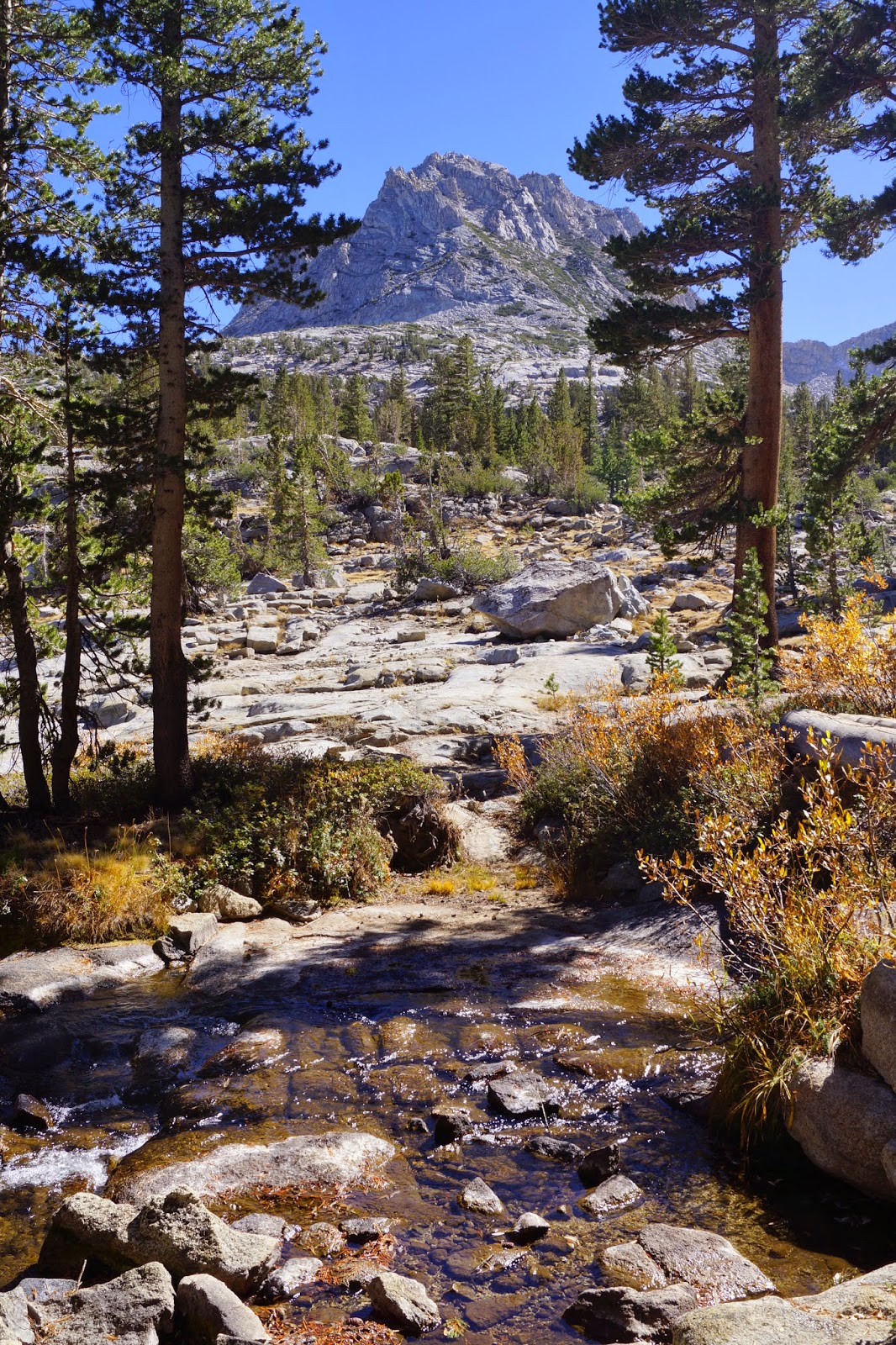
The trail crosses what I believe must be Bishop Creek a few times.


The elevation gets up to over 10,500 ft. so I began to slow down considerably. I wasn't bothered by the altitude except that hiking got harder. 


I had read in the Modern Hiker that this ledge was near the top. I kept thinking that surely over the next rise I'd see the lake. 


 But no. At this point you're really up high in the rocks, and more rocks.


Looking back to South Lake (which is very low now). The parking lot for the trailhead is by that dam.


Finally the lake and a break!


As I sat on a rock on the shore, I could watch the golden trout, California's state fish. Pretty cool.


Like many alpine lakes, Lower Treasure Lake sits in a bowl surrounded by mountains. I know their names but not which one is which: Hurd Peak, Mt. Goode, Mt. Johnson and Mt. Gilbert are all visible from here.


There are plenty of nice flat rocky spots surrounding the lake to rest or picnic or fish. I think I saw only eight people and about six dogs on the whole trail.  It was very quiet. 


On the way back down the sun was edging its way toward the mountains in the west.


Back at the trailhead I was already in the cool shadows of a setting sun.


It was a perfect Sunday. (And the Patriots won, so Rick was pretty happy too.)