"Could I have this dance for the rest of my life?" - Anne Murray
Showing posts with label biking. Show all posts

Wednesday, February 3, 2016

Whoa! We Sure Didn't See This Coming!

Read on dear friends, for the big reveal at the end of the story of our tour of The Golden Isles of Georgia. It's all Lynn and Glenn's fault, as usual.  They told us how much they liked Blythe Island Regional Park, near Brunswick, GA, and talked us into camping there for our traditional Thanksgiving dinner together. And, as usual, we had a great time with them, and except for the mosquitos, Blythe Island was a great place to camp. (Yes, there were too many trees to use the satellite dish, but we lived.)

Sites 87 & 88, Blythe Island Regional Park

Apologies for this post being a bit outdated (like over two months) but a lot has been going on (keep reading). In the few days we were there we managed to squeeze in lots of adventures, including Fort Frederica and Southern Soul BBQ on St. Simon's Island, and a bike tour of Jekyll Island

Beautiful oak alley at Fort Frederica

St. Simons Island was the site of a battle between the English and Spanish in 1742 that determined Georgia as an English colony.  After that battle the Fort and town were abandoned, and today the National Park Service maintains the area with the ruins as a beautiful park. 

Ruins of the Fort
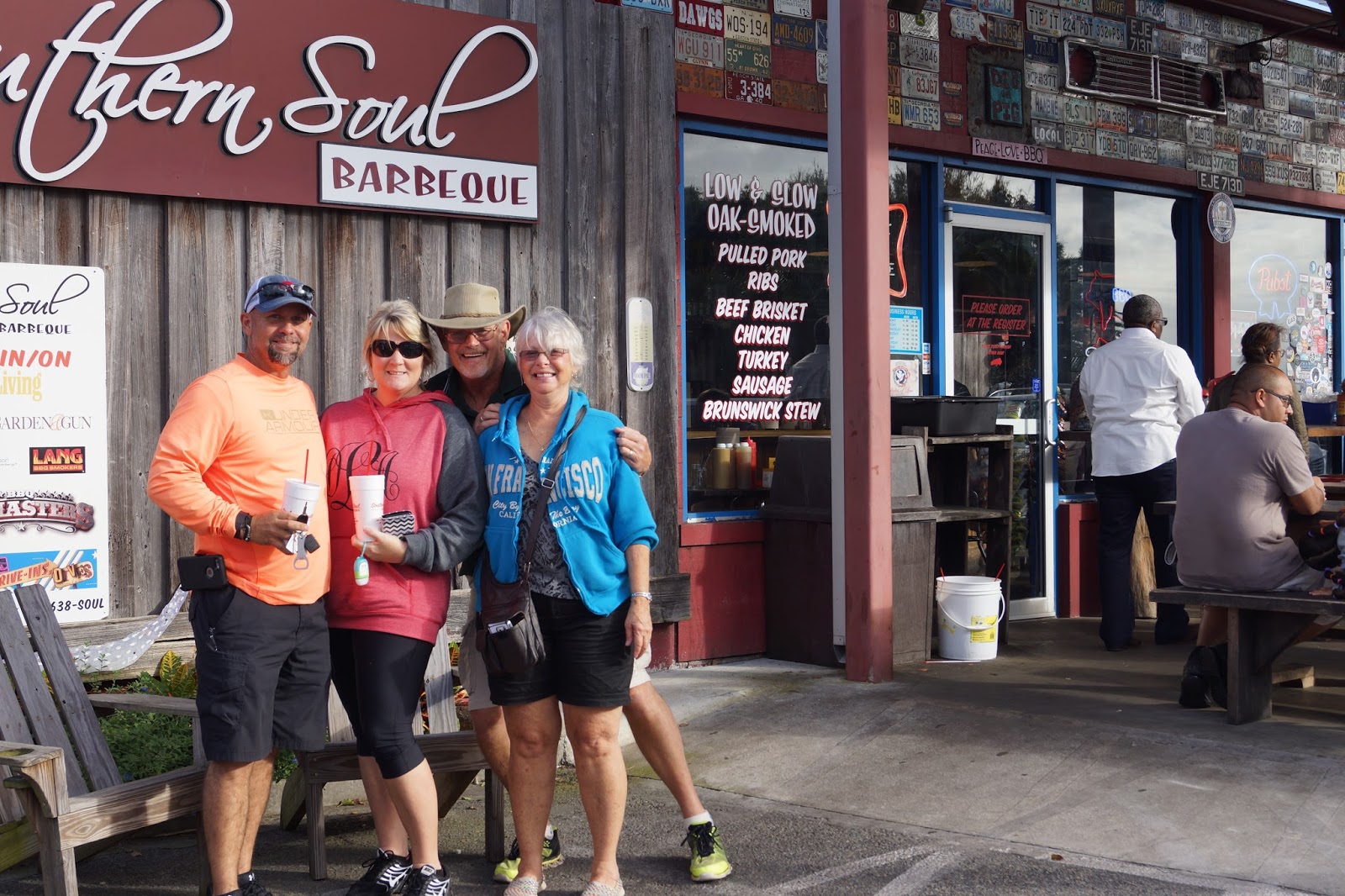
After a stroll through the Spanish moss draped live oak trees we headed over to the heavenly Southern Soul BBQ at the recommendation of Lynn & Glenn's friends Diva and Scott. Excellent choice! Everything, including the friend green beans, was delicious. We'll be going again, I'm sure.

Rib sandwich

Prime rib sandwich

Southern Soul BBQ, St. Simons Island

Scott, Diva, Glenn & Lynn 

Another day we drove out to Jekyll Island, about 20 minutes away from Blythe Island.  The bridge below is named for Sidney Lanier, who wrote a lovely poem entitled "The Marshes of Glynn County" that captures the unique beauty of the low country.

The beautiful Sidney Lanier bridge from Brunswick to nearby Jekyll and Blythe Islands

Here are some of those salt marshes, a rich ecosystem that comprises much of coastal Georgia and South Carolina.  It's a look that grows on you.

"The Marshes of Glynn County"

Once on the Island, we unloaded our bikes and started our circumnavigation along the west shore. The bike trail runs around the entire island, though we pooped out about 2/3 around.  See a map here.

A tiny bit of the island's fascinating history: Jekyll Island was the exclusive and private home of a "club" of millionaires at around the turn of the 20th century.  During the Great Depression their mansions were abandoned, and in 1947 the state of Georgia purchased the island at a steal, and it is now a state park. Development is strictly regulated by the state, and limited to only 1/3 of the island. The grand homes and the Jekyll Island Club Hotel remain, in various states of repair. There seemed to have been a brief housing boom in the 1960's and 70's, resulting in several neighborhoods of nice, but modest homes from that period, and there are a handful of hotels along the ocean. Since then development slowed, until recently, when a town center with several blocks of commerce, a Westin Hotel and a conference center were built.

Within the state park, some of the old homes are restored and open for tours.  Two thirds of the island is a historical and nature preserve and cannot be further developed. 

Moss Cottage within the Jekyll Island Club

The residents pedaled around the island on these "red bugs" for fun and exercise.

Rick and Glenn get serious again, this time about cars, thus the helmets.

The Jekyll Island Club Hotel is grand and very traditional. In the photo below there are actually some people playing croquet on the lawn. It really is like stepping back in time when you visit.

The Jekyll Island Club Hotel

The historic Faith Chapel within "The Club"

Also on the island is the Georgia Sea Turtle Center where in addition to caring for sea turtles, they will treat any injured wild animal that is found on the island.

Georgia Sea Turtle Center. Here they examine a snake that was brought in by the man on the right.

At the Center there are about eight large tanks where injured sea turtles are rehabilitated so they can safely return to the sea.


They also raise a certain number of turtles from eggs.

Wee baby sea turtles with numbers painted on their backs, for the big race later on??

Near the golf course, modern day "red bugs" are available for rent.


Along the bike trail we visited the Horton House, historic ruins of the earliest white settlers on the island:


Driftwood Beach is a must see on the northeast side of the island. 

The gang of four on Driftwood Beach

Driftwood beach

As we pedaled along the ocean side of the island, almost back to the truck, we passed a new development of condos.  We didn't think too much about them at the time, except to admire their location and think what a cool place this would be to live. 
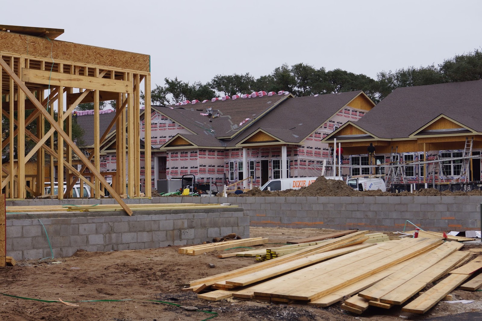


Well, long story finally made short, we returned back to Jekyll Island a month later, after the holidays with our family, and bought one.  Settling down was not in the forefront of our minds by any means. But if we stay open to possibilities, these opportunities show up in our lives and we just have to pay attention.  Now we can hardly think of anything else. Our new home won't be available to us until Fall 2016, so we will have time to travel up and down the east coast before we have to wrap our heads around moving in.

So, our full-time RVing lives will be changing later this year, but we hope to keep the RV and keep traveling for vacations. We'll just work that out as we go.  

People often ask us if we look for the perfect place to settle down as we travel around the country, and I have to say we don't do that too much. Occasionally we find places we really love, but they aren't necessarily places we'd like to stay, or we aren't ready to stay. I've come to believe that there is no perfect place. There's just the place you are. Another time, Jekyll Island might not have captured us the way it did now. Another place could have captured us instead.  For whatever reason, we've been captured and captivated, and we look forward to loving it all.

Sunday, August 16, 2015

Biking the Route of the Hiawatha

At the suggestion of our friends Lynn and Glenn, we are in St. Regis, Montana for a week, primarily to ride this well known and loved 15 mile bike trail through the forests and hills of Idaho and Montana.  We are staying at a great campground, the Nugget RV Park, which I highly recommend.  Aside from very nice facilities it has acres and acres of wooded and well groomed hiking trails perfect for pet walking and wildlife viewing (many deer, turkeys and a fox so far).

Me at the start of the trail

The Route of the Hiawatha was originally the Pacific extension of the Milwaukee Railroad. It took almost 9,000 men (mostly immigrants), $234 million and three years to build this challenging section of the railroad. It is now named after its last train, the Hiawatha Olympian, which ran for only only a short time before the railroad line went bankrupt.

Map from Official Route of the Hiawatha website

The trial is now jointly owned and managed by the U.S. Forest Service and Lookout Pass Ski Area, which is located on the state line between Montana and Idaho right off I-90 Exit 0.  

Lookout Pass Ski Lodge
The line for tickets


Parking lot at Lookout Pass and view into Idaho

The Trail can be accessed in several ways at multiple locations, but the easiest and most popular is to purchase trail and shuttle passes at Lookout Pass, rent bikes there if needed, and then drive to I-90 Exit 5 (Montana) and a few more miles on a dirt road, park, and enter the trail there at the East Portal. That's what Rick, our friend Kate and I opted to do.

Parking and unloading at East Portal

East Portal, where trail-masters check your passes and ensure you are safely equipped
for the ride with helmets, water and strong head or handlebar lights.

The very first feature that we encountered, after the trail-master's tent, is a 1.7 mile dark tunnel, with water running down the walls, dripping from the ceiling and into gutters on each side.  It was one of eeriest multi-sensory experiences I have ever had. There is no sound but the distance distorted echoes of other riders and running water. There is no wind, and the air is thick with moisture to the point of being like fog reflecting light from your head lamp, which is the only thing you see except for an occasional reflector and glimpses of the stone walls. It smells rich, deep, wet and earthy. And it's a chilling 45 degrees Fahrenheit.  The road surface is graded toward the edges so that the water runs into the gutters, but that also means its a little tricky to stay straight on course. The dark doesn't help one's sense of balance either. And it seems to go on forever. I got the strong feeling I had been transported to someplace in Middle Earth. 


But eventually we did see the light at the end of the tunnel and broke out into the heat of the day and fresh air. We were greeted by a sweet water fall right next to the trail. It's important to stop and turn off all your lights so that you still have enough battery power for the ride back. 


There are more tunnels, but none as long as the first... 


...and seven trestles of various lengths and heights. 


View from one of the trestles

The surface of the trail starts smooth, but it gets increasingly rocky and bumpy. We were all feeling it through our bike seats by the end of the trail. My super duper Specialized bike with full suspension (front and back shocks) was a real bottom saver. 


Smoke from fires in Idaho made the views a little less spectacular than they might have been on a clear day, but it was still beautiful and completely undisturbed by anything but the trail, trestles and tunnels. There are informational plaques interspersed along the trail that gave us an excuse to stop and stretch our legs.


It took us over three hours and it would have been good to have more snacks with us. After the fifteen miles, a shuttle picks everyone and their bikes up at the Pearson stop and returns to the end of the long tunnel for the last stretch.  The chill of the tunnel felt great at that point.


By the time we got to the truck we were hungry. It turned out to be a longer day than we expected. We returned Kate's rented bike to the lodge and hoped to get a meal there, but were sorely disappointed by the service (one woman to cook, serve and run the register, with many people waiting), so we headed home. 

Things to know if you want to ride the Route of the Hiawatha:

1. This is a great adventure for almost anyone who can ride a bike. We saw families with children, folks riding recumbent bikes, and rough and ready mountain bikers. It's downhill all the way so no hard peddling is required. It just takes people different amounts of time to do the trail, and the last shuttle is often at 4:15, with no other option for return but to ride the whole trail back again.

2. No pets are allowed on the trail.

3. Rentals of helmets, lights and various styles of bikes are available at the Lookout Pass Lodge.

4. Bring plenty of food and water, and don't expect much in the way of food service back at the Lookout Pass lodge.  There are a couple of thermos jugs placed along the trail to fill your water bottle, but they could be empty or you could easily miss them. There are also a couple of bathrooms on the trail. Study the map and keep your eye on the mileage markers and tunnel numbers to know how far you've got to go.

5. Those with poor night vision, serious fear of enclosed spaces or heights might want to think twice about riding the trail.

6. The website has plenty of good information, but it's hard to really imagine until you do it. Check it out


Tuesday, August 19, 2014

Diamond Lake, Oregon

We are at Diamond Lake RV Park for two weeks, located at the southeast corner of Diamond Lake.  We chose this location to be close enough to explore Crater Lake National Park, which is only about 20 miles away.  The rv park is much like a state park, but with full hook-ups and the kind of amenities usually found at private parks. The lake is surrounded by Forest Service campgrounds with hundreds of dry camping sites for small RVs and tents.  Other than the campgrounds though, there is very little development. There is a small restaurant/store at this end of the lake and a camp store at the other end of the lake where there is a "resort" with a lodge and some cabins. Very rustic everywhere. Oh, there's a gas station just past the north end of the lake. Other than that, it's 1 1/2 hours in any direction to a city large enough for a grocery store, a bank, car repair, etc. (Bend, Fort Klamath or Eugene). And there's very little cell service of any sort. 


On the east side of Diamond Lake is Mt. Theilsen (above, at sunset), and on the west is Mt. Bailey (below, at dawn) - both extinct volcanoes.


We've been biking the Diamond Lake Loop bike trail as often as possible. It's an eleven mile paved trail that goes - you guessed it - around the entire lake. 


It's a lovely trail that passes through forests, over streams and along the shoreline. It's mostly flattish, with a few manageable ups and downs - just enough to get a good workout. It takes about 1 1/2  hours to go around the lake. If you get an ice cream cone at the little store, it takes 2.

At our end of the lake there's a nice day-use area with picnic tables, a boat dock...


and plenty of places to take a dip in the chilly water. 


We took a drive over to Crater Lake and have plans to hike down to the Lake and take the boat tour later this week. We also took a drive to see the numerous waterfalls in the area. But mostly we're pretty happy just hanging out at the campground and the lake. Pretty idyllic...


The plan is to post something about Crater Lake and the waterfalls if the internet holds up. We'll see.

Thursday, February 6, 2014

Birding in the Tip-o-Texas

After our detour to the King Ranch in Kingsville, Texas, we continued our journey to the very southern tip of Texas to do some unique bird watching. There are lots of birds along the Rio Grande Valley, which forms the southern boundary between Texas and Mexico, that one can see nowhere else in the United States. We hoped we'd spot a few in a one day visit to a few well-known birding spots. 


Green jays

We got to Mission a little late to do much more than check in at La Quinta and find the Bentsen-Rio Grande Valley State Park to get our bearings for the next day. The sun was going down and the mosquitos were coming out so we didn't linger, but we did see a Great Kiskadee right near the Visitors' Center, but didn't get a picture. We spotted our first kiskadee about a month ago in Edna Texas and had no idea what it was. After much searching in our books and apps we finally identified it. It's something like a Western meadowlark, with its bright yellow breast, but it has a bold black eye stripe and cap, and a rust colored back, tail and wings. It's a striking bird and quite a thrill when we first found it. Down here though they are pretty common, and so don't cause as much excitement. Funny how that is.

We had dinner at Chili's for the first time in years, and I was struck with how insane a place it was. Not untypical, but after being away from this kind of stimulation, it hit me hard. No less than ten televisions going, loud music, and almost everyone looking at their own phone screens on top of that. Loud conversation from every direction too. Eeeek! But the food was good and reasonably priced.  We had a pleasant overnight at La Quinta - they're almost always fine.

Next morning, we were up and out bright and early. Bentsen-Rio Grande Valley State Park is closed to vehicles except for their tram, and bicycles. So we took our bikes and had a great time peddling around the roads with no traffic to contend with, and spotting birds.  First stop was the bird feeders at the guard house where we saw almost of every kind of bird we were going to see that day. These are chacalacas. They are BIG birds. 


Next up, Altamira Orioles.  All these birds around here really go for the citrus. One of the reasons they are feeding the birds is because of the multi-year drought. It's hard on the vegetation and thus, the birds.


Here's a Golden-fronted Woodpecker...


…and a Long-billed Thrasher.


My favorites were the green jays (up at the top of the post). Again, these are common around here so one can quickly get kind of ho-hum about them, but they are spectacular, don't you think? 

By the way, these are all life-birds for us. Before leaving the park we also spotted some other life birds: Black-crested Titmice, a Blue-gray Gnatcatcher, more Kiskadees, a few Gray Colored Thrushes and a female Merlin. No decent photos of any of those though.

Second stop of the day were some bad tacos at a local place. I don't know if this is a typical thing, but there were sliced hot dogs mixed in with both of our tacos, one chicken and one steak. That was a first for us.  Not thrilled with the effect.

Final stop, way down south of Brownsville, was the Sabal Palms Audobon Sanctuary.  It's pretty remote, and we definitely felt like we were already in Mexico. We had to cross "the fence" to get there, even though we didn't have to cross the actual border or the Rio Grande.  The sabal palm is the only palm native to Texas, and is evidently kind of rare now. This is one of the largest stands left of them, and the trails wind through the palm forest. 

We didn't see any additional birds at Sabal Palms except for these Neotropical Cormorants.  There were definitely other birds at both places, but they were the kind that we're not so good at seeing yet, like warblers and sparrows - little brownish birds that are hard to spot and so hard to identify. Oh well.


Oh, in addition we also scoped out one RV park in Mission:  Bentsen Palms Village, right next to the Bentsen - Rio Grande Valley State Park.  It's a perfect spot for birding enthusiasts, especially those who also like to bicycle. It's a high-end ownership park with lots of amenities in a quickly developing area.  They also rent sites for those who just want to visit.  While there are many, many other RV parks in the area to choose from, it may be the nicest and its "away from the madding crowd" that surrounds Interstate 2/Rt. 83.

All in all, it was definitely worth taking a little "vacation" to see the birds. If we pass through this area again I think we'll stay awhile.