I may not have mentioned it previously, but we are surrounded on three sides here at Cajun Palms RV Resort by sugarcane. This has made us curious about it, and our latest day trip has answered a lot of our questions. Those of you who are not the slightest bit curious about where your sugar comes from can skip down to the nice pictures of Oak Alley Plantation.

I don't know how it happened, but I'm a farm girl at heart. I was born and raised in New York City and its suburbs. My parents were from out west and we drove across the country often to visit family. Maybe all that farmland we passed in the car just rubbed off on me. As a youngster I used to get up at 5:00 AM to watch The Farm Report on television. God's honest truth. Harvesters and combines with a bowl of cereal before school every morning.
Rick and I are both pretty interested in agriculture and the manufacturing that happens after the harvest. Our travels have given us lots of opportunity to learn, but a lot of it is guesswork based on what we're seeing, supplemented by the internet and talking with the locals, so take this all with a grain of salt. I may be a farm girl at heart, but that's the only kind of farm girl I am.
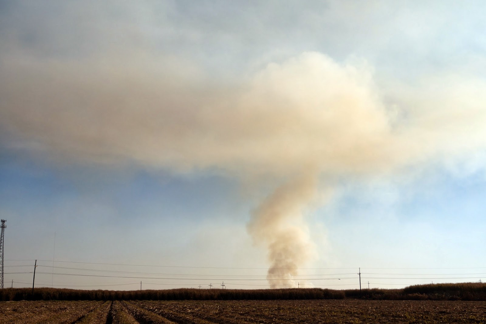
It's harvest season here, so we're seeing plenty of action. The picture up top is the sugarcane harvest right in our backyard. Below are the trucks carrying the cut cane to the processing plants.

Let me backtrack just a bit. As we drive through the countryside here we see sugarcane of two sizes: short and tall. The explanation seems to be that sugarcane is a two (or three?) year crop. The short, immature crop just gets burned down. When it is ready to be harvested it is about 8 feet tall and dried brown. Harvest happens in December, as does burning, so we're seeing both.
We think we can recognize sugarcane processing plants now. They usually have lots of smoke/steam stacks going full force and huge shed-like structures. Our day trip took us south of Baton Rouge along Route 405, the River Road, and we saw quite a few sugar plants.

Here you can see the trucks filled with cane lined up outside of a processing plant.

In this picture you can see what we think is a pile of waste fiber outside of the plant.

Historically the sugar plantations were established along the Mississippi River, both because of the fertile soil and the easy access to shipping and boat travel along the river. Below, on this piece of a map, you can see the long skinny plantation properties all along the river on both sides. The whole map, by artist Lisa Middleton, shows all the plantations along the river from Natchez to New Orleans. (We think our guide told us that the green ones are sugarcane.) The plantation we visited is one of the smaller green ones on the west bank. It is now called Oak Alley.

Sugar was as big a crop here as cotton was in other parts of the south. It really built this part of the country. Like all southern plantations, these were dependent upon slave labor. When visiting Oak Alley, the first buildings you see are reconstructed slave cabins. Inside the cabins there are exhibits of typical furnishings as well as information about the slave trade and the nature of the slaves' lives on the plantation.

We were guided through the main house by a young man dressed in period clothing.

The house is three stories high, with at least four large rooms and a central hall on each floor. It is furnished as you might expect a wealthy antebellum home to be. Like in Gone With the Wind. All the guides are dressed in period clothing.

The house is surrounded by three hundred year old live oaks.
Around here they are the signature of the landscape.

This is the million dollar view that the plantation was named for:

We were the only people walking along this allee (that's French). We felt so privileged to be there, and grateful that some of these places have been preserved and are open to the public. We know there are many plantations in the south, but we really haven't been visiting them. Some in the area are still private homes and farms, and some have been turned into inns with spas and restaurants. Many are long gone.
We saw other kinds of manufacturing plants on our drive as well. This one was CF Industry's nitrogen plant. (Don't ask - I don't know.) Among other things, it makes the urea based DEF fluid that we use in our truck.

We could tell that some of them were oil refineries and petroleum or gas related plants because of the huge storage tanks…

… and the pipes going across the road, over the levee and out to the tanker ships on the river. Before now we never really understood the extent of the levee system along the Mississippi and its tributaries. We started seeing the levees in Memphis, and since then we rarely actually see the river because of the levees on both sides. The Mississippi Delta has a long history of flooding of course and the levees have been around in some form for centuries.


Next post, I'll be getting back to nature.
I'm trying to read this and very interested, but the font color is too light. Could you edit it?
ReplyDeleteSorry Jenna. On my screen the background is dark brown and the font is white. What is it on your screen?
DeleteIt is actually just as you've described now, but the colors we blending earlier. I'm not sure what happened. I enjoyed the post!
ReplyDeleteGreat. Glad you enjoyed it. This was one of our favorite places to visit.
Delete