"Could I have this dance for the rest of my life?" - Anne Murray
Showing posts with label Nevada. Show all posts

Wednesday, December 31, 2014

2014 - A Year of Dancing on the Edge

No big deal, I'll just pick a few highlights of the year and post a review. Oh boy, what was I thinking? It was not a year to review lightly. Although we traveled through only eight states, some were the biggest and arguably the most spectacular in the country. So how am I going to do this? Systematically or randomly? Thematically or chronologically? Logically or emotionally? Geez, so many choices. Well, let's see what develops if I just jump in.

We started full-timing in 2011, and we've covered much of the country, except for those pesky tornado-ridden flat states smack in the middle. Somehow we just can't seem to get to them. No offense to the Heartland, but it just isn't as compelling as those states around the edges. We covered a lot of completely new territory for us this year, in some pretty exciting and "edgy" places, many of them the least populated areas of the western USA.

We brought in 2014 on the southern edge of the country at a New Year's bash in Vermillionville, Lafayette, Louisiana, dancing to Geno Delafose's Cajun/Zydeco music. 


Then we two-stepped along the Gulf Coast of Texas to spend a peaceful month beach combing on Mustang Island. 


We salsaed down to the southernmost tip of Texas during that time to do some exotic bird watching on the border of Mexico.

Green Jay


My son Mark joined us in Texas for a chunk of the winter, and we took in some old and new sights while cooling our heals along the southern edge of Texas and New Mexico. 

Mark - Enchanted Rock, TX


Guadalupe Mountains National Park


Early spring found us tangoing inland, making our way diagonally northwest through Arizona. While in Pheonix we hit my now all-time-favorite museum: the Musical Instrument Museum.


We crossed over into Utah to spend a glorious month at Zion National Park, one of our 
all-time-favorite places. We were joined by Steve and Wendy, two of our all-time-favorite people, with whom we waltzed in the Park.


Continuing our diagonal trek, eastern Nevada was a big surprise - much more textured and scenic than we expected. We eased on up the Great Basin Highway and the Loneliest Road, making stops at Great Basin National Park and the Bonneville Salt Flats. 

Great Basin National Park


Bonneville Salt Flats, Utah


Crystal Crane Hot Springs, OR

We tight-roped much of our Spring on the edge between the Oregon Cascades and the Oregon desert, in Bend. This started our season of dodging the wildfires in the western states. 


Painted Hills, OR


Two Bulls Fire, Bend, OR


We gently dropped our RV in Springfield, Oregon for some repairs, while we boogied on toward the northwest corner of the country. After a brief and lovely visit with our good friends Nick and Cindy in Gig Harbor, we burst into our greatest adventure yet - the Great Edge that is Alaska. For this first venture into Alaska we decided on two of the most popular places - the Inside Passage and Denali National Park. Anchorage served as a base for other smaller cakewalks into the surrounding areas.

Glacier Bay National Park, AK


Seward, AK


Three bull moose, Denali National Park, AK


North Sawyer Glacier, Tracy Arm Fjord, AK


Our flight back to the lower 48 brought us to Seattle, another visit with Nick and Cindy in Gig Harbor, and a reunion celebration with our rig. 

Gig Harbor and Mt Rainier, WA


We spent the rest of our Summer and Fall in California, swinging our way south along the eastern edge the Sierra Nevadas. It was our first time in the Sierras and after hearing so much about how uniquely beautiful that area is, we have to concur. From Lake Tahoe, to Mono Lake, to Yosemite, to Death Valley, eastern California is a real wonderland. 

Lake Tahoe, CA


Mono Lake, CA


Yosemite National Park, CA


Death Valley National Park CA

And here we are, finishing up 2014 in Southern California, krumping around the edges of Los Angeles, the largest metropolis in the country. (Well, to be truthful, we are actually on the edges of San Diego right now.) In any case, it's a pretty major change after spending so much time hiding in the hinterlands of the California mountains and deserts. 

San Dimas, CA


Guess where, CA


It was a year of extremes, ranging north to Alaska and south to the Mexican border; 

Glacier National Park, AK and El Paso, TX


...from the pale salt of Bonneville Flats to the textured rainbow of the Valley of Fire. 


...from the lows of Death Valley to the heights of Mount Whitney; 


...from the peopled buzz of southern California to the pristine remotes of Alaska; 

Santa Monica Pier, CA and Denali National Park, AK


...and from smoke filled skies to crystal clear altitudes.

Yosemite National Park, CA and Ancient Bristlecone Pine Forest, CA


It was a year for wonderful dances with good friends (Nick and Cindy,  Lynn and Glenn, Wendy and Steve, so many Chicago buddies and DMT friends) and family (The Hoyles, The Herveys and dearest Mark).

It was also a year of changes. We hugged and kissed goodbye to our foldable kayaks and Ms. Subaru, who took us 85,000 miles into our journey. We welcomed two new inflatable kayaks into our family and hope to be introduced to a new car any day now. 

We're deeply grateful for all our new and old partners, and for our natural world that reminds us daily of the wonder and goodness all around us, and we wish the same for all of you. 

Remember, keep your dance card open
and have a Happy New Year.

Thursday, October 9, 2014

South on 395 Through the Eastern Sierras: Part One

Our journey through the Eastern Sierra Nevadas really started in Lake Tahoe, but connectivity has been sketchy, so we're starting here now, with high hopes of being able to continue a series.

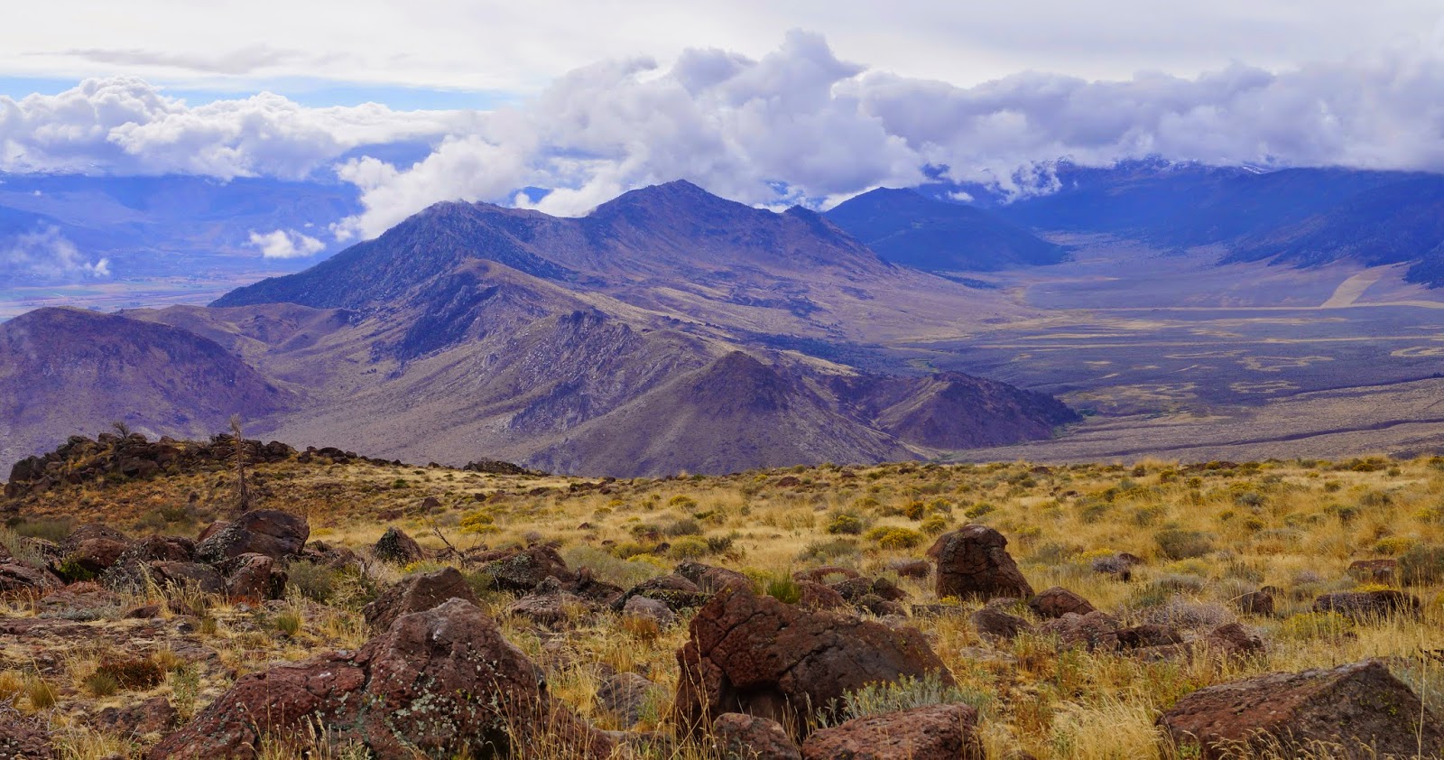
Here on the eastern side of the Sierras, it looks much like Nevada - a dry, near desert landscape with various mountain ranges surrounding the wide valleys that makes up the Great Basin.


Early morning on Golden Gate Rd., Walker, CA

At the moment, "here" is Lee Vining, California, the town closest to Mono Lake. "Then," a couple of days ago, was Coleville/Walker, CA. I'll just take this post to revisit our travels based out of there. We parked at the Meadowcliff KOA, right between Coleville and Walker, in beautiful Antelope Valley. The campground and motel have just recently joined the KOA gang, so you know what that means about the price. But the owners are taking great care of the place, doing much landscaping and rearranging. Everything is very clean and pleasant. It's nestled at the foot of a massive cliff that provides much appreciated late afternoon shade, and catches the early morning light too.

It's a sparsely populated area, devoted mostly to ranching and fishing on the Walker River, renown for its trout.  Both towns are kind of spread out through the valley, so you get very little sense of them being "towns," but there are a few good solid restaurants to recommend. The one right at the Meadowcliff KOA is great for breakfast and lunch (try the cinnamon rolls), and the Mountain View BBQ is a friendly hangout that serves up some yummy BBQ, coleslaw and local Mammoth beer at dinner time. Say Hi to Jeff for us if you stop by. Also the Walker Burger is a classic. All three are very homey and seem to be run by people who care a lot about the quality of their establishments, food and service.

We were in Walker for a little over a week and made a bunch of day trips.  On the first morning I was up at dawn to explore the area. After checking out Mill Canyon and Golden Gate Roads in Walker, I ended up at the Topaz Lake Recreation Area where there is a campground, a boat launch and a few trails to hike.


Topaz Lake

One day we drove Monitor Pass/Rt. 89 from Topaz Lake over to Markleeville...

View from Monitor Pass

...and on to the Grover Hot Springs State Park. The hot springs are channeled into two concrete pools, one hot and one not. There are showers, restrooms, dressing rooms, and a small admission fee. After a quick soak we drove to Gardnervile and Minden, NV, the closest cities with grocery stores, car washes, barber shops and hardware stores to do errands. 

(Side note: Every time you cross back into California from any other state, you have to pass through these check points where they are supposedly looking for produce that might carry pests from other states. But we can't figure out what they're really looking for. Sometimes they ask where you're coming from, sometimes not. Sometimes they ask if you have any produce, but when we showed them a list of the produce we had in the RV fridge, they said "What's this?" and acted like they had no interest in our fresh produce at all. Another time they asked if we had any houseplants. Honestly, I have no idea what they're after.) 

Another day, we travelled south to the ghost town of Bodie State Historic Park and enjoyed a very different kind of photographic experience for us. Bright midday sun threatened to bleach out everything, but the colors of the aged wood, rusted metal, tin roofs and siding, and the bright blue sky came through anyway.


One day we drove the high and dramatic Sonora Pass/Rt. 108 from Bridgeport to Dardenelle. What amazing scenery.

Looking east toward the Sweetwater Mountains

"Columns of the Giants" lava formations
 Once you get up into the mountains, and cross over the passes, you leave the Great Basin and the terrain changes to support large evergreens such as sugar pines, Jeffrey and ponderosa pines. The landscape is crisscrossed with streams and dotted with mountain lakes. This is the classic rocks, trees and water triumvirate of the Sierras.

Sardine Falls it the distant center (I think)

Walker River, above Leavitt Falls

Stanislaus River

I topped off our week with a hike to Roosevelt and Lane Lakes via Leavitt Meadow Trail (off of Sonoma Pass/Rt. 108). Sometimes I do these longer hikes alone and take along my Personal Locator Beacon. I got lucky this time and met a nice guy named Kevin who I walked with almost all the way to the lakes.  Often these chance meetings work out well. For the most part, I think hikers are friendly, interesting, and interested people, who are happy for company even if they start out hiking alone (like me!). 

Leavitt Meadow Trail

The trail starts at Leavitt Meadows, and then ascends up through the typical large rounded rocks and evergreens of the Sierras. The scattered groves of willows and aspens had just turned bright gold this week. Eventually there are at least four lakes along or near that trail: Roosevelt,  Lane, Secret and Fremont. Lots of hikers go up to camp and fish for several days. I just went about 4 miles to the second lake, which I think was Lane Lake.

Roosevelt Lake

I had the lakes pretty much to myself once I got there. 

Lane Lake

Perfect place for a picnic lunch before heading back down. 

Roosevelt Lake


So, now we've caught up to Lee Vining, where we have easy access to Mono Lake, and the grandest pass of them all: Tioga Pass/ Rt. 120.  For my next post...


Friday, September 19, 2014

Smokey Days in Sparks, Nevada

The weather here in Sparks, NV is hot and dry, with a lovely afternoon breeze. Unfortunately there's a down side to these otherwise pleasant conditions.  The King Fire (I had no idea they named fires) has been blazing since we arrived, 70 miles west of here, near Pollock Pines, California. At this point it covers almost 70,000 acres and is only 10% contained. The dry, windy weather is not helping the firefighters.  This effects us almost every afternoon at about 4:00 when a vast murky cloud blows slowly into the Reno/Sparks valley and shrouds us in smoke, ash and unpleasant smells, and then sits there until the next morning when it usually has blown away.  


Being Easterners we have had almost no experience with forest or wildfires that are now so common in the far western states.  Our first experience with a widespread forest fire that lasted for many days was the Two Bull Fire in Bend Oregon early this summer (below).


Interestingly, life doesn't stop with a fire nearby. Everything local seems to go on as normal, even though there is intense fire fighting activity less than an hour away.  We hear the reports on local radio of evacuations and the numbers of firefighters, trucks and helicopters that are deployed to battle this fire, but here in Sparks we do errands, swim, hike or take our recreational outings in the mornings, and gripe about the smoke in the afternoons. Strange. 


We can read updated reports on the it and any other fire on a great app for the iPhone called US Fires that gives the locations on a map or a list, with important information like distance from where we are, evacuation warnings and road closures. It also provides links to other more detailed maps and sources of local information. The app is free but you have to purchase each state at a nominal fee. I wouldn't travel in the West without it. 


Our stay here at the Sparks Marina RV Park has been uneventful. It's the kind of suburban RV park where every store you might ever need, plus car washes ands restaurants are practically in walking distance.  We've been in the boonies for about a month so we did chores, stocked up on supplies and groceries, did a little indulgent shopping and successfully completed a much needed RV roof repair job (thank you Rick).  No really big adventures except a drive over to the north end of Lake Tahoe. More about that in our next post, as we're heading that way tomorrow.